IMAGES TAKEN NEAR TO
Bryant Close, MANCHESTER, M13 9DL

Introduction

This page details the photographs taken nearby to Bryant Close, M13 9DL by members of the Geograph project.

The Geograph project started in 2005 with the aim of publishing, organising and preserving representative images for every square kilometre of Great Britain, Ireland and the Isle of Man.

There are currently over 7.5m images from over14,400 individuals and you can help contribute to the project by visiting https://www.geograph.org.uk

Image Map


Images are licensed for reuse under creativecommons.org/licenses/by-sa/2.0
Notes
  • Clicking on the map will re-center to the selected point.
  • The higher the marker number, the further away the image location is from the centre of the postcode.

Image Listing (87 Images Found)

Images are licensed for reuse under creativecommons.org/licenses/by-sa/2.0
  • ...
Image
Details
Distance
1
Plymouth Grove
The newly renovated Plymouth Grove Hotel. See an earlier photograph Image] and for a view of how it looked circa 1969 see MMU's picture on flikr - https://flic.kr/p/qUuLMF
Image: © Peter McDermott Taken: 29 May 2017
0.03 miles
2
Plymouth Grove Hotel
The Plymouth Grove Hotel undergoing renovation. For an earlier photograph see Image
Image: © Peter McDermott Taken: 22 Nov 2015
0.03 miles
3
the now disused 'Plymouth Grove' public house
Built I believe in around 1874 is this magnificent Victorian pub.
Image: © Steve Fareham Taken: 20 Jan 2009
0.03 miles
4
Detail of former Plymouth Grove Hotel, Plymouth Grove, Manchester
Tremendously elaborate. Someone really went to town for this pub Image
Image: © Stephen Richards Taken: 15 May 2012
0.04 miles
5
Former Plymouth Grove Hotel, Plymouth Grove, Manchester
A sorry sight, at least as far back as 2009 (Image]). Few pubs can ever have boasted such a prodigious clock tower (Image]). Built 1873. Grade II listed. Since this photo was taken, I understand permission has been granted for conversion to flats. Update: by 2015 work was underway: Image
Image: © Stephen Richards Taken: 15 May 2012
0.04 miles
6
Cycle and pedestrian lane near Ardwick
An off road route for walkers and cyclists from the A5184 to Kincardine Road. The skyline of Manchester can be seen also.
Image: © Bradley Michael Taken: 26 Nov 2015
0.04 miles
7
Grove Village
Building work off Plymouth Grove.
Image: © Gerald England Taken: 24 Nov 2014
0.08 miles
8
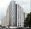
Nick Everton House
Opened in 2007 at the corner of Upper Brook Street and Grafton Street. Designed mainly as superior student accommodation with 24 hour security, it also houses workers from the nearby Manchester Royal Infirmary.
Image: © Gerald England Taken: 14 Aug 2009
0.11 miles
9
St Saviour's Churchyard
A grassy mound marks the site of the church, surrounded by the churchyard with gravestones.
Image: © David Martin Taken: 7 Jul 2011
0.12 miles
10
Plymouth House, Plymouth Grove
Image: © N Chadwick Taken: 17 Dec 2011
0.12 miles
  • ...