IMAGES TAKEN NEAR TO
Dickenson Road, MANCHESTER, M13 0NR

Introduction

This page details the photographs taken nearby to Dickenson Road, M13 0NR by members of the Geograph project.

The Geograph project started in 2005 with the aim of publishing, organising and preserving representative images for every square kilometre of Great Britain, Ireland and the Isle of Man.

There are currently over 7.5m images from over14,400 individuals and you can help contribute to the project by visiting https://www.geograph.org.uk

Image Map


Images are licensed for reuse under creativecommons.org/licenses/by-sa/2.0
Notes
  • Clicking on the map will re-center to the selected point.
  • The higher the marker number, the further away the image location is from the centre of the postcode.

Image Listing (52 Images Found)

Images are licensed for reuse under creativecommons.org/licenses/by-sa/2.0
  • ...
Image
Details
Distance
1
Inner city terraced houses - Rusholme
-
Image: © Jeff Thomas Taken: 21 Apr 2005
0.04 miles
2
Levenshulme
Property on the corner of Dickenson Road and Birch Lane in Levenshulme,
Image: © Peter McDermott Taken: 17 Sep 2018
0.05 miles
3
Back Lane
Back lane in Rusholme.
Image: © Peter McDermott Taken: 31 Jan 2021
0.06 miles
4
The Church of God of Prophecy
The Church of God of Prophecy, Dickenson Road, Longsight.
Image: © David Dixon Taken: 19 Aug 2011
0.08 miles
5
St John's, Longsight
The former Church of St. John the Apostle and Evangelist was founded in 1846. The oldest of the churches in Longsight, in 1979 St John's amalgamated with St Cypian's Church. It closed in 1993. It is now The Qadria Jilania Islamic Centre. http://manchesterhistory.net/LONGSIGHT/CHURCH/stjohns.html
Image: © Gerald England Taken: 29 Apr 2017
0.09 miles
6
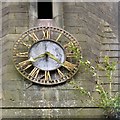
St John's Clock
Clock on the former St John's Church Image
Image: © Gerald England Taken: 29 Apr 2017
0.09 miles
7
Church of St John the Apostle and Evangelist
The Church of St John the Apostle and Evangelist is on the corner of Holmfirth Street and St John's Road, in Longsight, Built between 1845 and 1846, It is the oldest of the churches in Longsight. When it opened, the church was capable of holding 900 worshippers. It closed in 1993 and has since re-opened as an Islamic Centre. The building is Grade II listed (http://manchesterhistory.net/LONGSIGHT/CHURCH/stjohns.html Manchester History Net).
Image: © David Dixon Taken: 19 Aug 2011
0.09 miles
8
Corner of Dickenson Road and St John's Road
The A6010 turns left off Dickenson Road into St John's Road as it reaches Longsight Market although a short spur continues to meet the A6 Stockport Road at a T-junction.
Image: © Gerald England Taken: 31 Jul 2021
0.09 miles
9
St John's, Longsight
The former Church of St. John the Apostle and Evangelist was founded in 1846. The oldest of the churches in Longsight, in 1979 St John's amalgamated with St Cypian's Church. It closed in 1993. It is now The Qadria Jilania Islamic Centre. http://manchesterhistory.net/LONGSIGHT/CHURCH/stjohns.html
Image: © Gerald England Taken: 29 Apr 2017
0.10 miles
10
Longsight Market
Image: © David Dixon Taken: 19 Aug 2011
0.10 miles
  • ...