IMAGES TAKEN NEAR TO
Plymouth Grove, MANCHESTER, M13 0BG
Introduction
This page details the photographs taken nearby to Plymouth Grove, M13 0BG by members of the Geograph project.
The Geograph project started in 2005 with the aim of publishing, organising and preserving representative images for every square kilometre of Great Britain, Ireland and the Isle of Man.

There are currently over 7.5m images from over14,400 individuals and you can help contribute to the project by visiting https://www.geograph.org.uk
Image Map
Images are licensed for reuse under creativecommons.org/licenses/by-sa/2.0
Notes
- Clicking on the map will re-center to the selected point.
- The higher the marker number, the further away the image location is from the centre of the postcode.
Image Listing (87 Images Found)
Images are licensed for reuse under creativecommons.org/licenses/by-sa/2.0
Image
Details
Distance
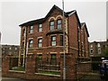
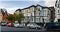
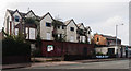
5
Triangular Junction
The builders of Hathersage Road and Richmond Grove created an elegant triangular junction, complete with gracefully curved terraced housing on at least two sides.
Image: © Peter Whatley
Taken: 21 Jan 2009
0.07 miles
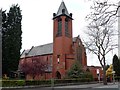
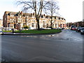
7
Plymouth Grove
Taken at the junction with Plymouth Grove West and Hathersage Road.
Image: © Peter Whatley
Taken: 21 Jan 2009
0.11 miles
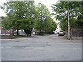
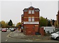
8
Longsight
Derelict buildings on the A6, Stockport Road, in Longsight.
Image: © Peter McDermott
Taken: 1 Nov 2014
0.14 miles
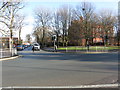
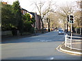
9
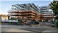
Chadwick Place
A new development on Stockport Road.
Image: © Peter McDermott
Taken: 10 Oct 2021
0.14 miles