IMAGES TAKEN NEAR TO
Baring Street, MANCHESTER, M1 2PY

Introduction

This page details the photographs taken nearby to Baring Street, M1 2PY by members of the Geograph project.

The Geograph project started in 2005 with the aim of publishing, organising and preserving representative images for every square kilometre of Great Britain, Ireland and the Isle of Man.

There are currently over 7.5m images from over14,400 individuals and you can help contribute to the project by visiting https://www.geograph.org.uk

Image Map


Images are licensed for reuse under creativecommons.org/licenses/by-sa/2.0
Notes
  • Clicking on the map will re-center to the selected point.
  • The higher the marker number, the further away the image location is from the centre of the postcode.

Image Listing (934 Images Found)

Images are licensed for reuse under creativecommons.org/licenses/by-sa/2.0
  • ...
Image
Details
Distance
1
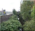
River Medlock
Downstream from Baring/Boardman Street bridge. On the right is a development called Mill Point. Since 2014 Image buildings on the left have been demolished and the site made into a car park run by SIP (Simple Intelligent Parking [sic]).
Image: © Gerald England Taken: 21 Feb 2019
0.01 miles
2
River Medlock from Baring Street
Part of the high level section of the Mancunian Way can be seen ahead.
Image: © David Dixon Taken: 5 Feb 2014
0.01 miles
3
River Medlock from Bond Street
Image: © David Dixon Taken: 5 Feb 2014
0.01 miles
4
Bridge on Baring Street
Although maps name this as "Baring Street", a plaque on the bridge (Image]) commemorates the "reconstruction of the Boardman Street Bridge" - perhaps this used to be called Boardman Street?
Image: © David Dixon Taken: 5 Feb 2014
0.02 miles
5
River Medlock
Downstream from Baring/Boardman Street bridge.
Image: © Gerald England Taken: 24 Sep 2022
0.02 miles
6
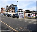
Baring Street
The street is an overspill parking area for taxis waiting to join the ranks at Piccadilly Station. In the background work is ongoing to turn the former Mayfield Station into an events venue.
Image: © Gerald England Taken: 21 Feb 2019
0.02 miles
7
River Medlock - Upstream of Mancunian Way
Image: © John M Taken: 22 Nov 2011
0.02 miles
8
River Medlock
Looking upstream from Boardman Street (Baring Street) bridge.
Image: © Gerald England Taken: 14 Aug 2009
0.02 miles
9
Baring/Boardman Street Bridge
On the wall by the bridge over the River Medlock is a plaque commemorating the reconstruction of the Boardman Street Bridge by the Corporation of Manchester in 1907 Image There are virtually no other references to Boardman Street and this is now Baring Street Image The scene was quite derelict looking in 2009 Image but as the sign says "Innovation used to thrive here, now it's back with a bang." The former Mayfield Station is being turned into an events venue and other things are happening nearby.
Image: © Gerald England Taken: 21 Feb 2019
0.02 miles
10
The bridge on Baring Street
See how this looked in 2009 Image To the right was a brick wall. To the left another wall. Behind was a derelict landscape and the remains of the disused Mayfield station. Forward to 2019 Image To the right now is an industrial unit and a sign saying "Innovation used to thrive here, now it's back with a bang." On the left work has begun on transforming the old station. Now the industry on the south side of the River Medlock has been swept away and on the left is Escape to Freight Island Image, a restaurant space inside the former freight depot, all part of Depot Mayfield. Either side of the bridge there is access the newly created Mayfield Park. On the wall by the bridge is a plaque commemorating the reconstruction of the Boardman Street Bridge by the Corporation of Manchester in 1907 Image There are virtually no other references to Boardman Street and this is now Baring Street.
Image: © Gerald England Taken: 1 Oct 2022
0.02 miles
  • ...