IMAGES TAKEN NEAR TO
Store Street, M1 2FX

Introduction

This page details the photographs taken nearby to Store Street, M1 2FX by members of the Geograph project.

The Geograph project started in 2005 with the aim of publishing, organising and preserving representative images for every square kilometre of Great Britain, Ireland and the Isle of Man.

There are currently over 7.5m images from over14,400 individuals and you can help contribute to the project by visiting https://www.geograph.org.uk

Image Map


Images are licensed for reuse under creativecommons.org/licenses/by-sa/2.0
Notes
  • Clicking on the map will re-center to the selected point.
  • The higher the marker number, the further away the image location is from the centre of the postcode.

Image Listing (801 Images Found)

Images are licensed for reuse under creativecommons.org/licenses/by-sa/2.0
  • ...
Image
Details
Distance
1
Millbank Street
A private street Image leading from Store Street Image to Piccadilly Village.
Image: © Gerald England Taken: 12 Jun 2014
0.02 miles
2
Store Street
Development alongside the Store Street.
Image: © Peter McDermott Taken: 15 Jun 2019
0.03 miles
3
Benchmark, Ancoats, Store Street
Detail of the worn Ordnance Survey cut benchmark on the corner of a stone wall at the junction of Millbank Street and Store Street. The benchmark marks a height of 39.65m above mean sea level (Ordnance Datum Newlyn) last verified in 1964 (location photograph Image).
Image: © Adrian Taylor Taken: 19 Feb 2023
0.03 miles
4
Wall corner, Millbank Street
At the junction of Store Street and Millbank Street the stone wall originally supported a tarpaulin works. There is an Ordnance Survey cut benchmark low down on one of the cornerstones of the wall (detail photograph Image).
Image: © Adrian Taylor Taken: 19 Feb 2023
0.03 miles
5
Store Street
Viewed from Store Street aqueduct on the Ashton Canal.
Image: © Thomas Nugent Taken: 2 Apr 2013
0.03 miles
6
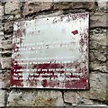
Sign on the wall at Millbank Street
The sign on Millbank Street Image off Store Street Image reads: MILLBANK STREET This is a private street and use is restricted to visitors to PICCADILLY VILLAGE and ASH OF ANCOATS. Any unauthorised vehicles will be clamped or removed at the expense of the owners. A pederstrian right of way only exists along the footpath on the southern side of the street. This path is not maintained at public expense.
Image: © Gerald England Taken: 12 Jun 2014
0.03 miles
7
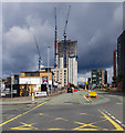
Oxygen Tower
Looking along Great Ancoats Street towards the Oxygen Tower development.
Image: © Peter McDermott Taken: 26 Jul 2020
0.03 miles
8
The Ashton Canal
At Piccadilly Village which was built in the early 1990s on the derelict site of goods wharves and a metal works known as Phoenix Works.
Image: © Thomas Nugent Taken: 2 Apr 2013
0.04 miles
9
Ashton Canal, Piccadilly Village
Image: © David Dixon Taken: 19 May 2010
0.04 miles
10
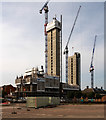
Oxygen
The Oxygen development on Store Street.
Image: © Peter McDermott Taken: 3 Aug 2019
0.04 miles
  • ...