1
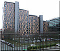
Buxton Street
The apartment block on the left is Mill Point. Ahead is part of the MacDonald Manchester Hotel.
Image: © Gerald England
Taken: 14 Aug 2009
0.01 miles
2
Buxton Street, Manchester
In the background, at the far end of the street, is the former Mayfield station.
Image: © Malc McDonald
Taken: 25 Apr 2014
0.01 miles
3
Buxton Street Car Park
Image: © Anthony Foster
Taken: 4 Aug 2022
0.02 miles
4
Unite Tower, Buxton Street, Manchester
Viewed from platform 14 at Manchester Piccadilly station, the building is used for student accommodation and was opened in 2007. Baring Street goes along the left-hand side of the building, Travis Street is in front. Part of the former Mayfield railway station, which hasn't been used for more than 25 years, is to the left of the picture.
Image: © El Pollock
Taken: 8 Jun 2014
0.02 miles
5
Student Accommodation
On Buxton Street, viewed from Piccadilly railway station.
Image: © Thomas Nugent
Taken: 28 Jan 2013
0.03 miles
6
Student accommodation building, Buxton Street, Manchester
Image: © JThomas
Taken: 9 Mar 2013
0.03 miles
7
MacDonald Manchester Hotel
From the platform at Piccadilly Station.
Image: © Stephen Sweeney
Taken: 7 Apr 2009
0.04 miles
8
Piccadilly Point
The view from platform 14 at Piccadilly Station. On the left is Piccadilly Point https://www.unitestudents.com/manchester/piccadilly-point student accommodation run by Unite Students. On the right is Macdonald Manchester Hotel.
Image: © Gerald England
Taken: 28 Sep 2017
0.04 miles
9
Manchester, Baring Street
The high rise building on the left is called Piccadilly Point. It is student accommodation.
Image: © David Dixon
Taken: 29 Feb 2020
0.04 miles
10
River Medlock from Baring Street
Part of the high level section of the Mancunian Way can be seen ahead.
Image: © David Dixon
Taken: 5 Feb 2014
0.04 miles


