IMAGES TAKEN NEAR TO
Langport Avenue, MANCHESTER, M12 4NR

Introduction

This page details the photographs taken nearby to Langport Avenue, M12 4NR by members of the Geograph project.

The Geograph project started in 2005 with the aim of publishing, organising and preserving representative images for every square kilometre of Great Britain, Ireland and the Isle of Man.

There are currently over 7.5m images from over14,400 individuals and you can help contribute to the project by visiting https://www.geograph.org.uk

Image Map


Images are licensed for reuse under creativecommons.org/licenses/by-sa/2.0
Notes
  • Clicking on the map will re-center to the selected point.
  • The higher the marker number, the further away the image location is from the centre of the postcode.

Image Listing (43 Images Found)

Images are licensed for reuse under creativecommons.org/licenses/by-sa/2.0
  • ...
Image
Details
Distance
1
Gold Cup
The Gold Cup public house in Longsight.
Image: © Peter McDermott Taken: 1 Nov 2014
0.09 miles
2
Gold Cup
The Gold Cup public house on the A6, Stockport Road in Longsight.
Image: © Peter McDermott Taken: 17 Apr 2017
0.09 miles
3
Gold Cup
Pub on the corner of Stockport Road and Royds Close.
Image: © Gerald England Taken: 21 Mar 2012
0.09 miles
4
Longsight
New development in Longsight.
Image: © Peter McDermott Taken: 6 Aug 2016
0.12 miles
5
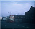
A Manchester bus in Stockport Road
Taken in October 1969, this photo shows a 1964 Daimler Fleetline with Metro- Cammell 76-seater bodywork operated by Manchester City Transport in Stockport Road. It is working route 94 from Southern Cemetery to Levenshulme (Lloyd Road) via Old Trafford and City Centre. An MCT bus stop can be seen to the right of the vehicle. This area has changed considerably in the intervening decades.
Image: © David Hillas Taken: 12 Oct 1969
0.12 miles
6
Stockport Road/ Hathersage Road junction
Image: © Colin Pyle Taken: 21 May 2010
0.16 miles
7
Plymouth Grove West is blocked off
It has a compound erected on the Stockport Road end. This is slightly inconvenient as it is a useful route through to Hathersage Road.
Image: © Bill Boaden Taken: 9 Jun 2015
0.16 miles
8
Coverdale Baptist Church
Coverdale Crescent, Ardwick
Image: © David Dixon Taken: 19 May 2010
0.17 miles
9
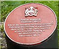
Fenian Ambush 1867
Plaque erected in 1989 by the railway bridge on Hyde Road, marking the site of the "Fenian Ambush" which led to the hanging of the so-called "Manchester Martyrs". Image
Image: © Gerald England Taken: 29 Aug 2009
0.17 miles
10
Manchester Martyrs
On 11th September 1867, the police arrested two men for behaving suspiciously in a doorway. The two, Colonel T.J.Kelly and Captain Deasy, were leading figures in the Fenian Rising. A week later, the prison van that carried the two handcuffed from court to Belle Vue Prison was ambushed by a crowd of thirty armed Fenians who had been lying in wait for it. After fatally shooting a police officer, the Fenians escaped with Kelly and Deasy (still handcuffed) never to be recaptured. Three of the ambushers were later executed for the murder of the policeman and went down in Irish Republican history as the "Manchester Martyrs" http://www.prideofmanchester.com/mancirish/history1.htm A plaque Image was erected on land by the side of the railway in 1989. The text reads "Fenian Ambush (September 1867) Site of the rescue of two Fenian prisoners. Following the shooting of a policeman three of the rescuers were executed at the last public hanging in the Manchester area (November 1867)." More information about these events can found at http://web.archive.org/web/20101017050222/http://www.historyireland.com/volumes/volume16/issue6/features/?id=114212
Image: © Gerald England Taken: 29 Aug 2009
0.18 miles
  • ...