IMAGES TAKEN NEAR TO
Ezard Street, M11 1QD
Introduction
This page details the photographs taken nearby to Ezard Street, M11 1QD by members of the Geograph project.
The Geograph project started in 2005 with the aim of publishing, organising and preserving representative images for every square kilometre of Great Britain, Ireland and the Isle of Man.

There are currently over 7.5m images from over14,400 individuals and you can help contribute to the project by visiting https://www.geograph.org.uk
Image Map
Images are licensed for reuse under creativecommons.org/licenses/by-sa/2.0
Notes
- Clicking on the map will re-center to the selected point.
- The higher the marker number, the further away the image location is from the centre of the postcode.
Image Listing (66 Images Found)
Images are licensed for reuse under creativecommons.org/licenses/by-sa/2.0
Image
Details
Distance
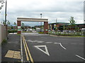
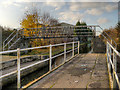
3
Edge Lane Business Centre, Openshaw - Manchester
At the junction of Fairfield Road and Edge Lane. The works building in the background was part of Ferguson Pailin/AEI/GEC/Alstom until closure.
Image: © John Topping
Taken: 9 Oct 2012
0.10 miles
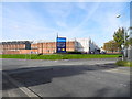
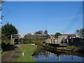
4
Morrisons Openshaw
Northwest entrance to car park.
Image: © John Topping
Taken: 29 Jun 2012
0.11 miles
5
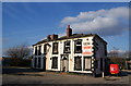
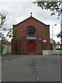
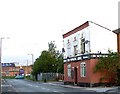
A pub in a sad state
This was the Yew Tree pub on Edge Lane.
Image: © Bill Boaden
Taken: 14 Apr 2010
0.11 miles
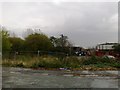
6
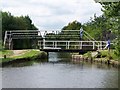
Bridge 14, Ashton Canal
Paired swing bridge and footbridge
Image: © David Martin
Taken: 2 Aug 2010
0.12 miles
7
Grimshaws Swing Bridge and Footbridge, Ashton Canal
Image: © John Slater
Taken: 22 Sep 2012
0.13 miles
8
Ashton Canal, Yew Tree Swing and Foot Bridges
Yew Tree footbridge and swing bridge are at the end of Buxton Lane. The crossing is named after a nearby pub, now closed (Image]). There was once a "Yew Tree Farm" in the area.
Note: I have seen this bridge referred to as "Grimshaw's Bridge" ( http://www.narrowboatworld.com/index.php/news-flash/4395-bw-pays-p500000-compensation Narrowboat World) but the British Waterways sign next to the bridge names it as "Yew Tree Bridge" (Image]).
Image: © David Dixon
Taken: 15 Nov 2012
0.13 miles
9
Fairfield Road
On the right hand side is the Bowling Green public house; it is still in use despite its appearance. Further down where the green car can be seen is the junction of Edge Lane and Fairfield Road. The building in the distance used to be an Electrical Engineering works but alas is no more.
Image: © Stephen Burton
Taken: 5 Oct 2005
0.13 miles
10
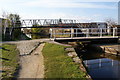
Yew Tree Swing Bridge
This crosses the Ashton Canal near the former Yew Tree pub on Edge Lane. The footbridge provides an alternative for when the bridge is open.
Image: © Bill Boaden
Taken: 14 Apr 2010
0.13 miles