IMAGES TAKEN NEAR TO
Saunton Road, MANCHESTER, M11 1AJ
Introduction
This page details the photographs taken nearby to Saunton Road, M11 1AJ by members of the Geograph project.
The Geograph project started in 2005 with the aim of publishing, organising and preserving representative images for every square kilometre of Great Britain, Ireland and the Isle of Man.

There are currently over 7.5m images from over14,400 individuals and you can help contribute to the project by visiting https://www.geograph.org.uk
Image Map
Images are licensed for reuse under creativecommons.org/licenses/by-sa/2.0
Notes
- Clicking on the map will re-center to the selected point.
- The higher the marker number, the further away the image location is from the centre of the postcode.
Image Listing (44 Images Found)
Images are licensed for reuse under creativecommons.org/licenses/by-sa/2.0
Image
Details
Distance
1
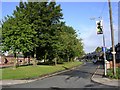
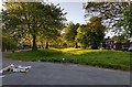
Eastern By-Pass - Again!
This road in Openshaw is a relic of a road scheme that ended before completion. This section of the Manchester Eastern By-Pass dates, I guess, from the late 1940's judging by the style of the housing here. It is not shown on the 1940's OS map. The only other evidence I have found for this scheme is a similar section in nearby Clayton, Image
Image: © Keith Williamson
Taken: 28 Sep 2005
0.04 miles
2
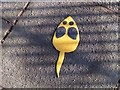
Follow me!
"Mouse" fixed to paving to guide children to a safe place to cross the road in Openshaw, Manchester. SJ88779779.
Image: © Keith Williamson
Taken: 28 Sep 2005
0.04 miles
3
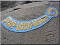
A little bird told me!
A reminder of what to do by a safe place for children to cross the road near a Primary School in Openshaw. SJ88779779.
Image: © Keith Williamson
Taken: 28 Sep 2005
0.04 miles
4
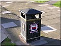
Place Your Litter Here.
A litter bin in Openshaw, Manchester. SJ88779779.
Image: © Keith Williamson
Taken: 28 Sep 2005
0.04 miles
6
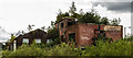
Crabtree Forge
The derelict Crabtree Forge buildings alongside the Ashton Canal. As the sign indicates, once operated by Eva Brothers Ltd - see http://www.gracesguide.co.uk/Eva_Brothers
Image: © Peter McDermott
Taken: 26 Jun 2017
0.15 miles
7
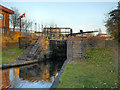
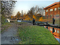
Lock 14, Ashton Canal
One of the Clayton flight of locks.
Image: © David Dixon
Taken: 15 Nov 2012
0.15 miles
8
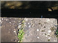
Pivot benchmark on lock 14 of the Ashton Canal
Image: © John Slater
Taken: 22 Sep 2012
0.15 miles
9
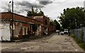
Crabtree Lane
The derelict Crabtree Forge buildings on Crabtree Lane. As the sign indicates, once operated by Eva Brothers Ltd - see http://www.gracesguide.co.uk/Eva_Brothers
Image: © Peter McDermott
Taken: 26 Jun 2017
0.16 miles