IMAGES TAKEN NEAR TO
Lowther Road, DUNSTABLE, LU6 3LL
Introduction
This page details the photographs taken nearby to Lowther Road, LU6 3LL by members of the Geograph project.
The Geograph project started in 2005 with the aim of publishing, organising and preserving representative images for every square kilometre of Great Britain, Ireland and the Isle of Man.

There are currently over 7.5m images from over14,400 individuals and you can help contribute to the project by visiting https://www.geograph.org.uk
Image Map
Images are licensed for reuse under creativecommons.org/licenses/by-sa/2.0
Notes
- Clicking on the map will re-center to the selected point.
- The higher the marker number, the further away the image location is from the centre of the postcode.
Image Listing (14 Images Found)
Images are licensed for reuse under creativecommons.org/licenses/by-sa/2.0
Image
Details
Distance
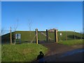
2
Reservoir, Stipers Hill
According to the 1:25000 map this is a reservoir which is bisected by the TL03 gridline. It is surrounded by a high fence, has CCTV and a green building bristling with aerials - I also had the feeling that I was being watched ...
Image: © Rob Farrow
Taken: 18 Jul 2006
0.11 miles
7
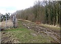
Footpath skirting quarry - View northwestwards
This muddy footpath follows the northeastern and northern edges of Image] and a little further on skirts the ancient strip lynchetts to the south of the Stipers Hill area of Dunstable. The view along the footpath in the opposite direction can be seen in Image]
Image: © Rob Farrow
Taken: 22 Feb 2009
0.23 miles
8
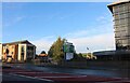
A5183 London Road, Dunstable
Watling Street, a Roman Road, formerly the A5.
Image: © Robin Webster
Taken: 7 Jan 2018
0.23 miles
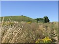
9
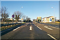
Stipers Hill
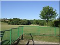
A tract of parkland at Stipers Hill at the southern fringe of Dunstable. There is a little carpark, a large open field and some scrubland. Nearby are some ancient cultivation terraces (strip lynchets).
Image: © Rob Farrow
Taken: 18 Jul 2006
0.24 miles
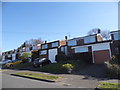
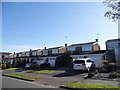
10
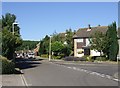
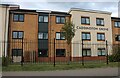
Stipers Hill - Estate Road
This area of Dunstable called Stipers Hill is a pleasant residential estate. Along this road they have the advantage of fronting onto open countryside.
Image: © Rob Farrow
Taken: 18 Jul 2006
0.24 miles