IMAGES TAKEN NEAR TO
Meadway, DUNSTABLE, LU6 3JT
Introduction
This page details the photographs taken nearby to Meadway, LU6 3JT by members of the Geograph project.
The Geograph project started in 2005 with the aim of publishing, organising and preserving representative images for every square kilometre of Great Britain, Ireland and the Isle of Man.

There are currently over 7.5m images from over14,400 individuals and you can help contribute to the project by visiting https://www.geograph.org.uk
Image Map
Images are licensed for reuse under creativecommons.org/licenses/by-sa/2.0
Notes
- Clicking on the map will re-center to the selected point.
- The higher the marker number, the further away the image location is from the centre of the postcode.
Image Listing (12 Images Found)
Images are licensed for reuse under creativecommons.org/licenses/by-sa/2.0
Image
Details
Distance
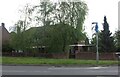
1
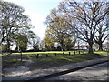
Dunstable Cemetery
The main West Street entrance to the Cemetery, which was established in 1861, and covers 6 hectares of this grid square.
Image: © Nigel Cox
Taken: 2 Apr 2006
0.16 miles
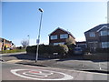
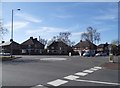
5
Roundabout on West Street, Dunstable
At the junction of Chiltern Road
Image: © David Howard
Taken: 10 Sep 2023
0.19 miles
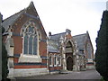
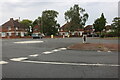
7
Westdown Gardens at the junction of Whipsnade Road
Image: © David Howard
Taken: 20 Apr 2016
0.21 miles

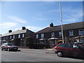
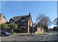
9
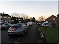
Looking NW along Canesworde Road
Private housing from the 1950-60s.
Image: © M J Richardson
Taken: 7 Dec 2008
0.24 miles