IMAGES TAKEN NEAR TO
Quarry Walk, DUNSTABLE, LU6 3FN
Introduction
This page details the photographs taken nearby to Quarry Walk, LU6 3FN by members of the Geograph project.
The Geograph project started in 2005 with the aim of publishing, organising and preserving representative images for every square kilometre of Great Britain, Ireland and the Isle of Man.

There are currently over 7.5m images from over14,400 individuals and you can help contribute to the project by visiting https://www.geograph.org.uk
Image Map
Images are licensed for reuse under creativecommons.org/licenses/by-sa/2.0
Notes
- Clicking on the map will re-center to the selected point.
- The higher the marker number, the further away the image location is from the centre of the postcode.
Image Listing (10 Images Found)
Images are licensed for reuse under creativecommons.org/licenses/by-sa/2.0
Image
Details
Distance
2
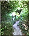
Footpath off Buttercup Lane
Buttercup Lane becomes a private road just after this footpath strikes off to the right. This footpath crosses Dunstable Downs Golf Course.
By the way - it was the fence that was leaning, not me !
Image: © Rob Farrow
Taken: 18 Jul 2006
0.16 miles

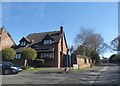
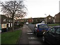
4
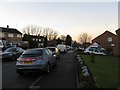
Looking NW along Canesworde Road
Private housing from the 1950-60s.
Image: © M J Richardson
Taken: 7 Dec 2008
0.19 miles
5
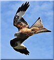
Red Kite in flight
Red Kites [Milvus milvus] have become very common in various parts of the UK since reintroduction programmes began in 1990. They frequently visit a garden in Dunstable to feed. The Chiltern Hills is where the first introductions took place.
Image: © Nicki Reeves
Taken: 15 Jun 2022
0.22 miles
6
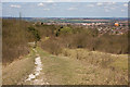
Footpath, Dunstable Downs
This footpath leads down to the B4541 on the outskirts of Dunstable.
Image: © Martin Addison
Taken: 8 Apr 2010
0.23 miles
7
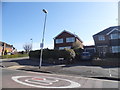
Westdown Gardens at the junction of Whipsnade Road
Image: © David Howard
Taken: 20 Apr 2016
0.24 miles
8
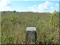
Five Knolls information, Dunstable Downs
Advising that the group of five round barrows dates from the late Neolithic or early Bronze Age and is protected by the Ancient Monuments Act.
Image: © Robin Webster
Taken: 19 Sep 2015
0.24 miles
9
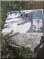
Information board beside the path
Detailing information about the tumuli and subsequent burials in the area. Very interesting.
Image: © Jeremy Bolwell
Taken: 14 Aug 2022
0.24 miles
10
Canesworde Road
Private housing from the 1950-60s.
Image: © M J Richardson
Taken: 7 Dec 2008
0.25 miles