
IMAGES TAKEN NEAR TO
Wood Street, DUNSTABLE, LU6 3FF
Introduction
This page details the photographs taken nearby to Wood Street, LU6 3FF by members of the Geograph project.
The Geograph project started in 2005 with the aim of publishing, organising and preserving representative images for every square kilometre of Great Britain, Ireland and the Isle of Man.

There are currently over 7.5m images from over14,400 individuals and you can help contribute to the project by visiting https://www.geograph.org.uk
Image Map
Images are licensed for reuse under creativecommons.org/licenses/by-sa/2.0
Notes
- Clicking on the map will re-center to the selected point.
- The higher the marker number, the further away the image location is from the centre of the postcode.
Image Listing (179 Images Found)
Images are licensed for reuse under creativecommons.org/licenses/by-sa/2.0
Image
Details
Distance
1

Grounds of the Priory Church of St Peter (iii)
Image: © Basher Eyre
Taken: 8 Sep 2011
0.03 miles
2
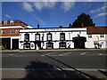
Dunstable: The 'Saracen's Head'
A very long-established hostelry
Image: © Dr Neil Clifton
Taken: 28 Sep 2015
0.03 miles
3

High Street South, Dunstable
Heading into the rain
Image: © David Howard
Taken: 4 Apr 2012
0.04 miles
4
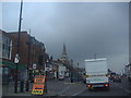
High Street South, Dunstable
The plethora of traffic lights ahead took around 15 minutes to clear around half a mile.
Image: © David Howard
Taken: 4 Apr 2012
0.04 miles
7
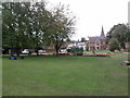
Church Gardens
Gardens in the grounds of Priory of St Peters Church
Image: © Gary Fellows
Taken: 17 Aug 2011
0.05 miles

9
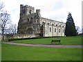
Dunstable: The Priory Church of St Peter
Building work on the Priory commenced around 1132, and took about eighty years to complete. Two storms in 1222 caused severe damage resulting in both towers at the western end collapsing, and the church was subsequently substantially rebuilt. The Church's website can be found here http://www.dunstableparish.org.uk/ptrrhint.htm
Image: © Nigel Cox
Taken: 2 Apr 2006
0.05 miles
10

Chew's House on High Street South, Dunstable
This a grade II listed building housing William Chew's School https://virtual-library.culturalservices.net/bedfordshire/vlib/0.digitised_resources/dunstable_chews_house.htm
Image: © David Howard
Taken: 25 Oct 2025
0.06 miles