IMAGES TAKEN NEAR TO
Wolseley Drive, DUNSTABLE, LU6 1FH
Introduction
This page details the photographs taken nearby to Wolseley Drive, LU6 1FH by members of the Geograph project.
The Geograph project started in 2005 with the aim of publishing, organising and preserving representative images for every square kilometre of Great Britain, Ireland and the Isle of Man.

There are currently over 7.5m images from over14,400 individuals and you can help contribute to the project by visiting https://www.geograph.org.uk
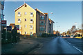
Image Map
Images are licensed for reuse under creativecommons.org/licenses/by-sa/2.0
Notes
- Clicking on the map will re-center to the selected point.
- The higher the marker number, the further away the image location is from the centre of the postcode.
Image Listing (40 Images Found)
Images are licensed for reuse under creativecommons.org/licenses/by-sa/2.0
Image
Details
Distance
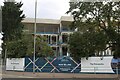
2
Tidy Bedrooms on Lawrence Way, Dunstable
Image: © David Howard
Taken: 22 May 2021
0.09 miles
4
Tidy Bedrooms on Lawrence Way, Dunstable
Here's an earlier visit. https://www.geograph.org.uk/photo/6847489
Image: © David Howard
Taken: 18 Dec 2022
0.09 miles
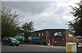
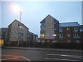
5
The Printworks, Dunstable
More new housing going up in what was a blank space on the map. I see this in virtually every field on town boundaries now as I pass through them. https://catalyst.homes/development/the-printworks/
Image: © David Howard
Taken: 2 Aug 2020
0.09 miles
6
Flats on High Street, Dunstable
The flats are accessed from Leyland Road, a small estate named after car makes, and not the first I've come across.
Image: © David Howard
Taken: 11 Feb 2017
0.10 miles
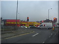
7
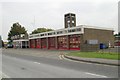
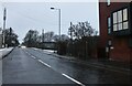
Dunstable fire station
Dunstable fire station, Brewers Hill Road, Dunstable, Bedfordshire
Image: © Kevin Hale
Taken: 7 Oct 2007
0.10 miles
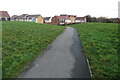
8
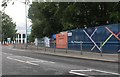
New estate on High Street North, Dunstable
The map shows this as an open space so another housing estate has taken over open land.
Image: © David Howard
Taken: 27 Jun 2020
0.10 miles
9
Flats, Dunstable
By High Street North, but on an estate with roads named after former British car marques.
Image: © Robin Webster
Taken: 7 Jan 2018
0.12 miles
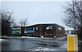
10
National Tyres, Dunstable
On the corner of Houghton Road and High Street North. The map shows a roundabout here but there isn't one now.
Image: © David Howard
Taken: 4 Apr 2012
0.12 miles