
IMAGES TAKEN NEAR TO
Allenby Avenue, DUNSTABLE, LU5 4QB
Introduction
This page details the photographs taken nearby to Allenby Avenue, LU5 4QB by members of the Geograph project.
The Geograph project started in 2005 with the aim of publishing, organising and preserving representative images for every square kilometre of Great Britain, Ireland and the Isle of Man.

There are currently over 7.5m images from over14,400 individuals and you can help contribute to the project by visiting https://www.geograph.org.uk
Image Map
Images are licensed for reuse under creativecommons.org/licenses/by-sa/2.0
Notes
- Clicking on the map will re-center to the selected point.
- The higher the marker number, the further away the image location is from the centre of the postcode.
Image Listing (23 Images Found)
Images are licensed for reuse under creativecommons.org/licenses/by-sa/2.0
Image
Details
Distance
1
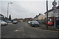
Dunstable : Evelyn Road
Looking along Evelyn Road in Dunstable.
Image: © Lewis Clarke
Taken: 25 Mar 2018
0.09 miles
2
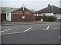
Luton Road Methodist Church
Across the A505 the Luton Road Methodist Church
Image: © Shaun Ferguson
Taken: 23 Mar 2010
0.11 miles
3
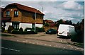
Evelyn Road, Dunstable
These houses are built on the site of the old Highfield County Primary School site. I don't know when the school was demolished and it is very hard to find anything out about the history of the school. If anyone has any info or pictures I'd be glad to hear from them.
Image: © Mike Goodwin
Taken: Unknown
0.13 miles
4
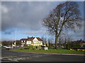
Dunstable: The Halfway
This roundabout marks the point at which Luton Road, Dunstable changes into Dunstable Road, Luton. The road is the A505 but follows the route of The Icknield Way here. The Halfway is now a Beefeater Restaurant and its address is 350 Luton Road, Dunstable.
Image: © Nigel Cox
Taken: 2 Apr 2006
0.15 miles
5
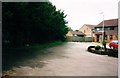
Site of Highfield County Primary School, Dunstable
The house to the rear is on Evelyn Road and is on the site of the old Highfield school. Immediately to the right of the line of trees and towards the back is the site of a classroom separate from the main building where in the 1960s a Miss Moss used to teach.
Image: © Mike Goodwin
Taken: Unknown
0.17 miles
6
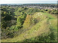
Path down to the former chalk pits
Dunstable in view in the distance.
Image: © Peter S
Taken: 5 Oct 2024
0.18 miles
7

Dunstable : Beefeater
A Beefeater seen on Luton Road.
Image: © Lewis Clarke
Taken: 25 Mar 2018
0.18 miles
8
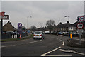
Dunstable : Poynters Road
Looking along Poynters Road from the roundabout.
Image: © Lewis Clarke
Taken: 25 Mar 2018
0.19 miles
9
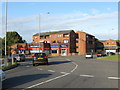
Poynter's Road Roundabout
On the A505 Dunstable-Luton Road. With flats and a crammer's premises in the angle with Poynters Road.
Image: © M J Richardson
Taken: 23 Sep 2017
0.20 miles
10
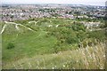
The Chalk Pit, Blow's Downs
My playground as a child, this was a quarry which was disused back in the 1950's.
Image: © Paul Buckingham
Taken: 12 Aug 2012
0.20 miles