
IMAGES TAKEN NEAR TO
Richard Street, DUNSTABLE, LU5 4BQ
Introduction
This page details the photographs taken nearby to Richard Street, LU5 4BQ by members of the Geograph project.
The Geograph project started in 2005 with the aim of publishing, organising and preserving representative images for every square kilometre of Great Britain, Ireland and the Isle of Man.

There are currently over 7.5m images from over14,400 individuals and you can help contribute to the project by visiting https://www.geograph.org.uk
Image Map
Images are licensed for reuse under creativecommons.org/licenses/by-sa/2.0
Notes
- Clicking on the map will re-center to the selected point.
- The higher the marker number, the further away the image location is from the centre of the postcode.
Image Listing (111 Images Found)
Images are licensed for reuse under creativecommons.org/licenses/by-sa/2.0
Image
Details
Distance
1
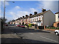
Dunstable: Great Northern Road
Houses on the west side of the road, looking southwards.
Image: © Nigel Cox
Taken: 2 Apr 2006
0.04 miles
2
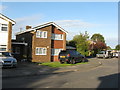
Allen Close, Dunstable
A housing estate cul-de-sac.
Image: © M J Richardson
Taken: 23 Sep 2017
0.12 miles
3
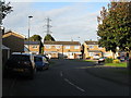
Housing estate on the edge of Dunstable
A small cul-de-sac on the edge of Blow's Down.
Image: © M J Richardson
Taken: 23 Sep 2017
0.13 miles
4
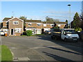
Allen Close, Dunstable
A small cul-de-sac of houses on the fringe of the town.
Image: © M J Richardson
Taken: 23 Sep 2017
0.14 miles
5
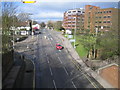
Dunstable: A505 Luton Road
Viewed looking west towards the centre of Dunstable from the former railway bridge.
Image: © Nigel Cox
Taken: 2 Apr 2006
0.15 miles
6
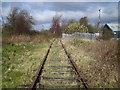
Dunstable: Disused railway near the former Dunstable Town station
Viewed looking northwards towards the site of the former Dunstable Town railway station, which was demolished when the Luton to Leighton Buzzard line closed for passenger traffic in 1965, the trackbed may be utilized by the proposed bus-operated Luton - Dunstable Translink system. Translink's website is here http://www.translinkexpress.org.uk/
Image: © Nigel Cox
Taken: 2 Apr 2006
0.18 miles
7
A5183 High Street South, Dunstable
Watling Street, a Roman Road, formerly the A5.
Image: © Robin Webster
Taken: 7 Jan 2018
0.18 miles
8
Downs Road, Dunstable
Looking east to Blow's Down.
Image: © M J Richardson
Taken: 23 Sep 2017
0.19 miles
9

Chew's House on High Street South, Dunstable
This a grade II listed building housing William Chew's School https://virtual-library.culturalservices.net/bedfordshire/vlib/0.digitised_resources/dunstable_chews_house.htm
Image: © David Howard
Taken: 25 Oct 2025
0.19 miles
10
New offices on Church Street, Dunstable
The Priory View complex was completed in late 2015
Image: © David Howard
Taken: 20 Apr 2016
0.20 miles