
IMAGES TAKEN NEAR TO
Caddington Park, Skimpot Lane, LUTON, LU1 4AZ
Introduction
This page details the photographs taken nearby to Caddington Park, Skimpot Lane, LU1 4AZ by members of the Geograph project.
The Geograph project started in 2005 with the aim of publishing, organising and preserving representative images for every square kilometre of Great Britain, Ireland and the Isle of Man.

There are currently over 7.5m images from over14,400 individuals and you can help contribute to the project by visiting https://www.geograph.org.uk
Image Map
Images are licensed for reuse under creativecommons.org/licenses/by-sa/2.0
Notes
- Clicking on the map will re-center to the selected point.
- The higher the marker number, the further away the image location is from the centre of the postcode.
Image Listing (9 Images Found)
Images are licensed for reuse under creativecommons.org/licenses/by-sa/2.0
Image
Details
Distance
1
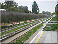
Luton & Dunstable Busway
This was taken at Stanton Road bus stop looking west along the busway tracks towards Dunstable. The busway was opened on 25th September 2013 and links various points in Dunstable and beyond with Luton Town Centre and Luton Airport. For much of its length it follows the course of a former railway that linked the two towns until its closure to passengers in 1965.
Image: © David Kemp
Taken: 26 Oct 2013
0.00 miles
2
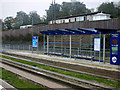
Luton & Dunstable Busway, Stanton Road stop
The busway was opened on 25th September 2013 and links various points in Dunstable and beyond with Luton Town Centre and Luton Airport. For much of its length it follows the course of a former railway that linked the two towns until its closure to passengers in 1965. There are two stops on the actual busway, Clifton Road and Stanton Road and the Dunstable side of the latter is seen here.
Image: © David Kemp
Taken: 26 Oct 2013
0.02 miles
3
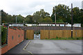
Entrance to Stanton Road busway stop
The only entrance to the Stanton Road busway stop is this un-signed gap in the fence at the end of Stanton Road itself. The stop is intended to serve the Luton & Dunstable Hospital which is some ten to fifteen minutes walk away at the opposite end of Stanton Road.
Image: © David Kemp
Taken: 26 Oct 2013
0.03 miles
4
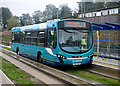
Arriva bus at Stanton Road bus stop
Three operators serve the Luton & Dunstable Busway. One of these is Arriva whose route A links Luton Airport with Parkside via Luton & Dunstable Town Centres and Houghton Regis. The Arriva bus seen here is a Volvo - Wrightbus Eclipse Urban specially adapted to operate in guided form on the busway.
Image: © David Kemp
Taken: 26 Oct 2013
0.04 miles
5
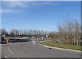
Chaul End Road at the junction of Hatters Way
In case anyone wasn't aware, Luton was famous for making hats, and is also the nickname of their football team.
Image: © David Howard
Taken: 20 Apr 2016
0.15 miles
7

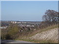
View from Chaul End Road, Luton
This is looking north across Leagrave
Image: © David Howard
Taken: 9 Jan 2022
0.18 miles
8
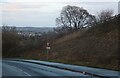
Chaul End Road, Luton
Looking towards Leagrave
Image: © David Howard
Taken: 9 Jan 2022
0.21 miles
9
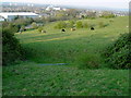
Field on Blows Downs With Grazing Cattle
Luton can be seen in the distance.
Image: © John Yaxley
Taken: 15 Apr 2007
0.25 miles