IMAGES TAKEN NEAR TO
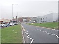
LS7 9FE
Introduction
This page details the photographs taken nearby to LS7 9FE by members of the Geograph project.
The Geograph project started in 2005 with the aim of publishing, organising and preserving representative images for every square kilometre of Great Britain, Ireland and the Isle of Man.

There are currently over 7.5m images from over14,400 individuals and you can help contribute to the project by visiting https://www.geograph.org.uk
Image Map (Loading...)


Getting Data...Please wait
Leaflet Map data © OpenStreetMap
Images are licensed for reuse under creativecommons.org/licenses/by-sa/2.0
Notes
- Clicking on the map will re-center to the selected point.
- The higher the marker number, the further away the image location is from the centre of the postcode.
Image Listing (124 Images Found)
Images are licensed for reuse under creativecommons.org/licenses/by-sa/2.0
Image
Details
Distance
1
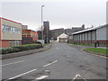
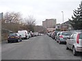
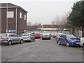
Sackville Street - Sheepscar Street North
Image: © Betty Longbottom
Taken: 8 Jan 2013
0.02 miles
2
Sheepscar Street North - viewed from Sackville Street
Image: © Betty Longbottom
Taken: 8 Jan 2013
0.02 miles
3
Sheepscar Street North - viewed from Sackville Street
Image: © Betty Longbottom
Taken: 8 Jan 2013
0.06 miles
4
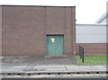
Electricity Substation No 4777 - Sackville Street
Image: © Betty Longbottom
Taken: 29 Jan 2013
0.07 miles
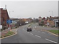
5
Sheepscar Street North - viewed from Barrack Street
Image: © Betty Longbottom
Taken: 29 Jan 2013
0.09 miles
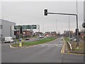
6
Barrack Street - Sheepscar Street North
Image: © Betty Longbottom
Taken: 29 Jan 2013
0.09 miles
7
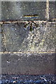
Benchmark on Barrack Street bridge
Ordnance Survey cut mark benchmark described on the Bench Mark Database at http://www.bench-marks.org.uk/bm76721
Image: © Roger Templeman
Taken: 4 Jul 2016
0.10 miles
8
Sheepscar Way - Sheepscar Street North
Image: © Betty Longbottom
Taken: 8 Jan 2013
0.10 miles
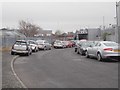
10
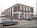
Lexicon House Urgent Care Centre - Barrack Street
Image: © Betty Longbottom
Taken: 29 Jan 2013
0.10 miles