IMAGES TAKEN NEAR TO
Grove Road, ILKLEY, LS29 9QF
Introduction
This page details the photographs taken nearby to Grove Road, LS29 9QF by members of the Geograph project.
The Geograph project started in 2005 with the aim of publishing, organising and preserving representative images for every square kilometre of Great Britain, Ireland and the Isle of Man.

There are currently over 7.5m images from over14,400 individuals and you can help contribute to the project by visiting https://www.geograph.org.uk
Image Map
Images are licensed for reuse under creativecommons.org/licenses/by-sa/2.0
Notes
- Clicking on the map will re-center to the selected point.
- The higher the marker number, the further away the image location is from the centre of the postcode.
Image Listing (56 Images Found)
Images are licensed for reuse under creativecommons.org/licenses/by-sa/2.0
Image
Details
Distance
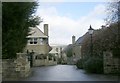
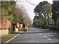
2
Houses in Grove Road, Ilkley
Opposite the eastern end of Heber's Ghyll Drive.
Image: © Humphrey Bolton
Taken: 28 Apr 2010
0.05 miles
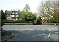
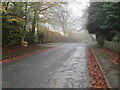
5
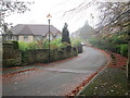
Grove Road - viewed from Beverley Rise
Image: © Betty Longbottom
Taken: 9 Mar 2009
0.07 miles
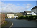
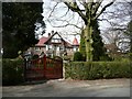
7
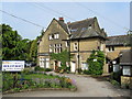
Holly Croft Residential Home
Large house converted into a residential care home on Hebers Ghyll Drive, Ilkley
Image: © Chris Heaton
Taken: 25 Apr 2011
0.08 miles
8
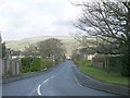
Beverley Rise - viewed from Grove Road
Image: © Betty Longbottom
Taken: 9 Mar 2009
0.08 miles
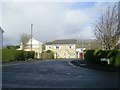
10
Houses in Grove Road, Ilkley
A pair of very large semi-detached houses, one with a corner turret.
Image: © Humphrey Bolton
Taken: 28 Apr 2010
0.10 miles