IMAGES TAKEN NEAR TO
North Croft Grove, ILKLEY, LS29 9BB
Introduction
This page details the photographs taken nearby to North Croft Grove, LS29 9BB by members of the Geograph project.
The Geograph project started in 2005 with the aim of publishing, organising and preserving representative images for every square kilometre of Great Britain, Ireland and the Isle of Man.

There are currently over 7.5m images from over14,400 individuals and you can help contribute to the project by visiting https://www.geograph.org.uk
Image Map
Images are licensed for reuse under creativecommons.org/licenses/by-sa/2.0
Notes
- Clicking on the map will re-center to the selected point.
- The higher the marker number, the further away the image location is from the centre of the postcode.
Image Listing (136 Images Found)
Images are licensed for reuse under creativecommons.org/licenses/by-sa/2.0
Image
Details
Distance
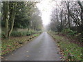
1
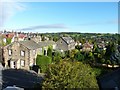
Ilkley chimneys
Looking north west from above Kings Road.
Image: © James Allan
Taken: 24 Sep 2010
0.02 miles
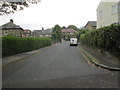
2
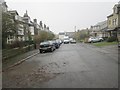
Westville Avenue - looking towards Westville Road
Image: © Betty Longbottom
Taken: 10 Nov 2014
0.05 miles
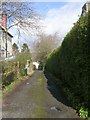
4

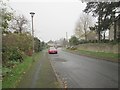
All Saints C of E Primary School - Skipton Road
Image: © Betty Longbottom
Taken: 9 Mar 2009
0.07 miles
9
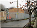
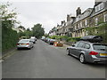
Electricity Substation No 5187 - Easby Drive
Image: © Betty Longbottom
Taken: 10 Nov 2014
0.10 miles
10
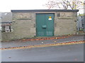
Electricity Substation No 4021 - Westville Road
Image: © Betty Longbottom
Taken: 10 Nov 2014
0.10 miles