IMAGES TAKEN NEAR TO
North Street, ILKLEY, LS29 0QY
Introduction
This page details the photographs taken nearby to North Street, LS29 0QY by members of the Geograph project.
The Geograph project started in 2005 with the aim of publishing, organising and preserving representative images for every square kilometre of Great Britain, Ireland and the Isle of Man.

There are currently over 7.5m images from over14,400 individuals and you can help contribute to the project by visiting https://www.geograph.org.uk
Image Map
Images are licensed for reuse under creativecommons.org/licenses/by-sa/2.0
Notes
- Clicking on the map will re-center to the selected point.
- The higher the marker number, the further away the image location is from the centre of the postcode.
Image Listing (150 Images Found)
Images are licensed for reuse under creativecommons.org/licenses/by-sa/2.0
Image
Details
Distance
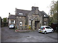
2
Old School & Old Schoolhouse - North Street
Image: © Betty Longbottom
Taken: 2 Mar 2009
0.01 miles
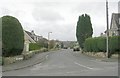
3
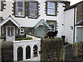
The Dales Way
#34, houses on North Street, Addingham.
Image: © Ian S
Taken: 19 Oct 2012
0.02 miles
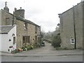
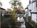
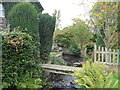
6
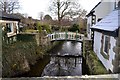
Town Beck, Addingham
Private footbridge over the beck on the route of the Dales Way long distance footpath
Image: © John Sparshatt
Taken: 30 Nov 2012
0.02 miles
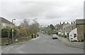
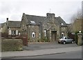
10
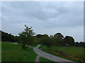
Addingham: looking back towards St Peter's
Image: © Basher Eyre
Taken: 12 Sep 2014
0.03 miles