
IMAGES TAKEN NEAR TO
Hunger Hill Road, ILKLEY, LS29 0DW
Introduction
This page details the photographs taken nearby to Hunger Hill Road, LS29 0DW by members of the Geograph project.
The Geograph project started in 2005 with the aim of publishing, organising and preserving representative images for every square kilometre of Great Britain, Ireland and the Isle of Man.

There are currently over 7.5m images from over14,400 individuals and you can help contribute to the project by visiting https://www.geograph.org.uk
Image Map
Images are licensed for reuse under creativecommons.org/licenses/by-sa/2.0
Notes
- Clicking on the map will re-center to the selected point.
- The higher the marker number, the further away the image location is from the centre of the postcode.
Image Listing (12 Images Found)
Images are licensed for reuse under creativecommons.org/licenses/by-sa/2.0
Image
Details
Distance
2
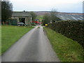
West Moor House Farm
Substantial farming operation on the edge of Middleton Moor.
Image: © Chris Heaton
Taken: 16 Dec 2009
0.02 miles

4
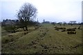
Footpath to West Moor House, Middleton
On the route of the Dales Way, Harrogate to Ilkley Link, long distance footpath
Image: © John Sparshatt
Taken: 26 Feb 2013
0.06 miles
5
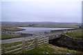
March Ghyll Reservoir drain, near Middleton
Image: © John Sparshatt
Taken: 26 Feb 2013
0.14 miles
6
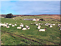
Sheep near East Moor House Farm
Farmland typical of this area on the south facing slopes of Langbar and Denton moors. Denton Moor is on the horizon beyond the farm.
Image: © David Spencer
Taken: 2 Oct 2005
0.15 miles
7
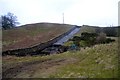
Overflow Drain from March Ghyll Reservoir
Image: © John Sparshatt
Taken: 26 Feb 2013
0.17 miles
9
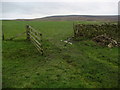
Pastures near March Ghyll Reservoir
Enclosed pastures to the south of the reservoir, allowing open views towards Beamsley Beacon - seen in the distance.
Image: © Chris Heaton
Taken: 16 Dec 2009
0.22 miles
10
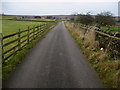
Access Road to West Moor House Farm
Long metalled access lane leads from Hill Top Farm towards West Moor House on the edge of Middleton Moor.
Image: © Chris Heaton
Taken: 16 Dec 2009
0.23 miles