
IMAGES TAKEN NEAR TO
Carters Lane, ILKLEY, LS29 0DQ
Introduction
This page details the photographs taken nearby to Carters Lane, LS29 0DQ by members of the Geograph project.
The Geograph project started in 2005 with the aim of publishing, organising and preserving representative images for every square kilometre of Great Britain, Ireland and the Isle of Man.

There are currently over 7.5m images from over14,400 individuals and you can help contribute to the project by visiting https://www.geograph.org.uk
Image Map
Images are licensed for reuse under creativecommons.org/licenses/by-sa/2.0
Notes
- Clicking on the map will re-center to the selected point.
- The higher the marker number, the further away the image location is from the centre of the postcode.
Image Listing (12 Images Found)
Images are licensed for reuse under creativecommons.org/licenses/by-sa/2.0
Image
Details
Distance

2
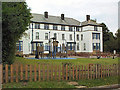
Westville House School
Private prep school. http://www.westvilleschool.co.uk/
Image: © David Spencer
Taken: 2 Oct 2005
0.12 miles
3
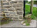
Middleton, Grange Farm
Grange Farm is on the south side of the road. There is a benchmark cut into the east facing wall of the old cow byre which is roadside. The building has been converted and is now a private residence.
Image: © Mel Towler
Taken: 27 Aug 2021
0.13 miles
4
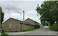
Middleton, Grange Farm
A wider angle showing Grange Farm on the south side of the road. The old cow byre which is roadside, has been converted and is now a private residence. There is a benchmark cut into the east facing wall of this house.
Image: © Mel Towler
Taken: 27 Aug 2021
0.13 miles
5

Gate Lodge, Middleton Hospital
Middleton Hospital, a former TB sanatorium, was finally closed in 1990, with most of the buildings being demolished in 1991. The Lodge is one of the few buildings remaining. The site has been subject to many battles with planners, in an attempt to transform the 57 acre site. The latest plans are to build a traditional "Country House", complete with separate staff accommodation, a stable block and tennis courts.
Image: © Iain Smith
Taken: 27 Aug 2010
0.15 miles
6
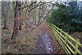
Woodland Footpath near Middleton, Ilkley
Image: © John Sparshatt
Taken: 23 Nov 2012
0.21 miles
7
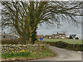
Start of Hunger Hill
The road, leading to the hamlet of Middleton (glimpsed in the distance) is shown as a no-through-road, but in practice there seems to be no physical barrier to through traffic.
Image: © Stephen Craven
Taken: 7 Mar 2020
0.21 miles
8
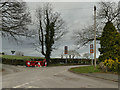
Junction of Slates Lane, Hunger Hill, Carters Lane and Curly Hill
On the outskirts of Ilkley, where town gives way abruptly to countryside (beyond the hedge is the start of the Nidderdale Area of Outstanding Natural Beauty).
Image: © Stephen Craven
Taken: 7 Mar 2020
0.22 miles

10
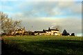
Cottages in Middleton
As seen from the bottom end of Hunger Hill
Image: © Chris Heaton
Taken: 20 Dec 2022
0.22 miles