
IMAGES TAKEN NEAR TO
Nesfield, ILKLEY, LS29 0BW
Introduction
This page details the photographs taken nearby to LS29 0BW by members of the Geograph project.
The Geograph project started in 2005 with the aim of publishing, organising and preserving representative images for every square kilometre of Great Britain, Ireland and the Isle of Man.

There are currently over 7.5m images from over14,400 individuals and you can help contribute to the project by visiting https://www.geograph.org.uk
Image Map
Images are licensed for reuse under creativecommons.org/licenses/by-sa/2.0
Notes
- Clicking on the map will re-center to the selected point.
- The higher the marker number, the further away the image location is from the centre of the postcode.
Image Listing (4 Images Found)
Images are licensed for reuse under creativecommons.org/licenses/by-sa/2.0
Image
Details
Distance
1
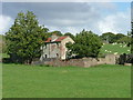
Semi-derelict farmhouse NNE of Nesfield
This unnamed farmhouse on the southwest edge of Middleton Moor seems to be unoccupied, possibly having been replaced by a modern farmhouse (Nessfield Court) 200 metres to the south.
Image: © Clare Smith
Taken: 1 Sep 2006
0.11 miles

3
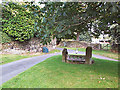
Stocks, Nesfield Village
Beyond the wall on the left is the well-concealed manor house.
Image: © David Spencer
Taken: 29 Sep 2005
0.23 miles
4
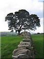
Dry stone wall
The tree is very close to where we expected to find High Lathe.
The building had vanished without trace!
Image: © Clare Smith
Taken: 1 Sep 2006
0.24 miles