IMAGES TAKEN NEAR TO
Rupert Road, ILKLEY, LS29 0AT
Introduction
This page details the photographs taken nearby to Rupert Road, LS29 0AT by members of the Geograph project.
The Geograph project started in 2005 with the aim of publishing, organising and preserving representative images for every square kilometre of Great Britain, Ireland and the Isle of Man.

There are currently over 7.5m images from over14,400 individuals and you can help contribute to the project by visiting https://www.geograph.org.uk
Image Map (Loading...)


Getting Data...Please wait
Leaflet Map data © OpenStreetMap
Images are licensed for reuse under creativecommons.org/licenses/by-sa/2.0
Notes
- Clicking on the map will re-center to the selected point.
- The higher the marker number, the further away the image location is from the centre of the postcode.
Image Listing (108 Images Found)
Images are licensed for reuse under creativecommons.org/licenses/by-sa/2.0
Image
Details
Distance
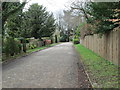
4
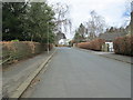
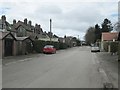
Rupert Road
Looking down Rupert Road from Clifford Road Junction.
Image: © Mrs W J Sutherland
Taken: 16 Feb 2024
0.06 miles
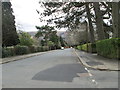
7
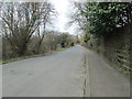
Nesfield Road
There is a rather faded road sign warning of a width limit ahead.
Image: © Stephen Craven
Taken: 7 Mar 2020
0.09 miles
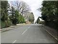
10
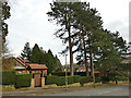
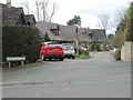
"Tall Pines", Langbar Road, Ilkley
The house name is very appropriate.
Image: © Stephen Craven
Taken: 7 Mar 2020
0.10 miles