
IMAGES TAKEN NEAR TO
LS2 8GF
Introduction
This page details the photographs taken nearby to LS2 8GF by members of the Geograph project.
The Geograph project started in 2005 with the aim of publishing, organising and preserving representative images for every square kilometre of Great Britain, Ireland and the Isle of Man.

There are currently over 7.5m images from over14,400 individuals and you can help contribute to the project by visiting https://www.geograph.org.uk
Image Map
Images are licensed for reuse under creativecommons.org/licenses/by-sa/2.0
Notes
- Clicking on the map will re-center to the selected point.
- The higher the marker number, the further away the image location is from the centre of the postcode.
Image Listing (1125 Images Found)
Images are licensed for reuse under creativecommons.org/licenses/by-sa/2.0
Image
Details
Distance
2

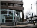
War Memorial - Wade Lane
Situated in the grounds of the Yorkshire Bank, this is dedicated to the men of Brunswick.
Image: © Betty Longbottom
Taken: 24 Sep 2007
0.03 miles

5
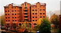
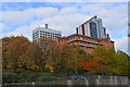
Q One, Lovell Park Road, Leeds
Former site of the Brunswick Methodist Chapel, Wade Lane, near the Merrion Centre.
When it was built, it was the largest Methodist chapel in existence but by 1953 there were 112 churches serving a population of 500,000 and its future was called into question, not least because of the nearby and more visually pleasing Oxford Place Methodist Chapel.
When the church organ was installed in 1827, it was described as 'the organ which cost 1,000 and 1,000 members', because it divided the congregation. Such was the division that members "left by the hundred" in protest, believing the introduction of an organ was somehow profane and that it diluted the meaning of church services.
In 1956, the church began screening films once a month after the evening service on Sunday. By the late 1970s, like many other churches, it was struggling financially and devoid of a congregation.
In 1980 planning permission was granted to the Mountleigh Group for a multi-storey office block to replace the church. Then, in 1982, there was talk of the derelict church becoming a mosque and in December 1983, thoroughly vandalised, it was being used by dossers and drunks. Today the site is occupied by an office block. It is not known what happened to the organ.
Image: © Mark Stevenson
Taken: 29 Nov 2014
0.03 miles
6
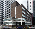
Hume House, Wade Lane, Leeds
This 1960s block is made to look almost dainty by its proximate neighbours, one a 1960s block itself, albeit re-clad, (Image]), and other the sort of modern tower-by-numbers now besmirching the city's skyline. Hume has ribbon windows and the interlocking blocks so much a feature of that period of architecture.
Image: © Stephen Richards
Taken: 18 Jun 2011
0.04 miles
7
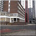
Hume House, Lovell Park Road, Leeds (1)
Currently empty, likely to be demolished
Image: © Rich Tea
Taken: 16 Feb 2018
0.04 miles
8
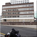
Hume House, Lovell Park Road, Leeds (2)
Showing 5 storeys of offices. Built in the 1960s and likely to be demolished soon.
Image: © Rich Tea
Taken: 16 Feb 2018
0.04 miles
9
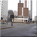
Hume House, Lovell Park Road, Leeds (3)
A view of this empty office building, across the junction of Wade Lane, Merrion Way and Lovell Park Road
Image: © Rich Tea
Taken: 16 Feb 2018
0.04 miles
