IMAGES TAKEN NEAR TO
Highcliffe Industrial Estate, Bruntcliffe Lane, LEEDS, LS27 9LR
Introduction
This page details the photographs taken nearby to Highcliffe Industrial Estate, Bruntcliffe Lane, LS27 9LR by members of the Geograph project.
The Geograph project started in 2005 with the aim of publishing, organising and preserving representative images for every square kilometre of Great Britain, Ireland and the Isle of Man.

There are currently over 7.5m images from over14,400 individuals and you can help contribute to the project by visiting https://www.geograph.org.uk
Image Map
Images are licensed for reuse under creativecommons.org/licenses/by-sa/2.0
Notes
- Clicking on the map will re-center to the selected point.
- The higher the marker number, the further away the image location is from the centre of the postcode.
Image Listing (49 Images Found)
Images are licensed for reuse under creativecommons.org/licenses/by-sa/2.0
Image
Details
Distance
1
Industrial Estate - Bruntcliffe Lane
Image: © Betty Longbottom
Taken: 1 Aug 2011
0.05 miles
3
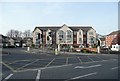
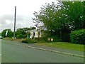
Fielding Court, Morley
Not surprising that the locality name 'Morley Hole' has not been used! The building is not in a Yorkshire vernacular style, but is attractive all the same.
Image: © Humphrey Bolton
Taken: 16 Mar 2010
0.09 miles
5
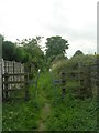
Footpath near Cemetery - Bruntcliffe Lane
Image: © Betty Longbottom
Taken: 1 Aug 2011
0.12 miles
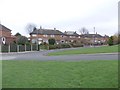
6
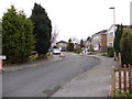
Bruntcliffe Drive - off Bruntcliffe Lane
Image: © Betty Longbottom
Taken: 28 Nov 2011
0.12 miles
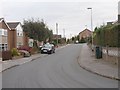
7
Bruntcliffe Close - Bruntcliffe Drive
Image: © Betty Longbottom
Taken: 28 Nov 2011
0.14 miles
8
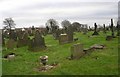
Morley Cemetery - Bruntcliffe Lane
Image: © Betty Longbottom
Taken: 26 Jan 2008
0.14 miles