IMAGES TAKEN NEAR TO
Malton Mews, LEEDS, LS27 8YT
Introduction
This page details the photographs taken nearby to Malton Mews, LS27 8YT by members of the Geograph project.
The Geograph project started in 2005 with the aim of publishing, organising and preserving representative images for every square kilometre of Great Britain, Ireland and the Isle of Man.

There are currently over 7.5m images from over14,400 individuals and you can help contribute to the project by visiting https://www.geograph.org.uk
Image Map (Loading...)


Getting Data...Please wait
Leaflet Map data © OpenStreetMap
Images are licensed for reuse under creativecommons.org/licenses/by-sa/2.0
Notes
- Clicking on the map will re-center to the selected point.
- The higher the marker number, the further away the image location is from the centre of the postcode.
Image Listing (26 Images Found)
Images are licensed for reuse under creativecommons.org/licenses/by-sa/2.0
Image
Details
Distance
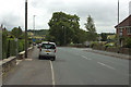
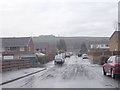
2
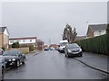
Topcliffe Avenue - looking towards Wide Lane
Image: © Betty Longbottom
Taken: 17 Mar 2012
0.11 miles
4
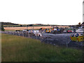
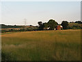
New housing under construction
On the south side of Wide Lane, Morley.
Image: © Stephen Craven
Taken: 18 Aug 2016
0.13 miles
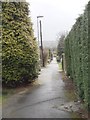
6
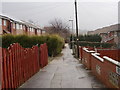
Topcliffe Court - Topcliffe Avenue
Image: © Betty Longbottom
Taken: 17 Mar 2012
0.14 miles
7
Topcliffe Green - Topcliffe Avenue
Image: © Betty Longbottom
Taken: 17 Mar 2012
0.15 miles
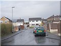
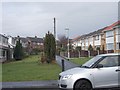
9
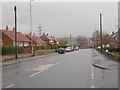
Wide Lane - viewed from Topcliffe Avenue
Image: © Betty Longbottom
Taken: 17 Mar 2012
0.16 miles