IMAGES TAKEN NEAR TO
Martin Close, LEEDS, LS27 8WF
Introduction
This page details the photographs taken nearby to Martin Close, LS27 8WF by members of the Geograph project.
The Geograph project started in 2005 with the aim of publishing, organising and preserving representative images for every square kilometre of Great Britain, Ireland and the Isle of Man.

There are currently over 7.5m images from over14,400 individuals and you can help contribute to the project by visiting https://www.geograph.org.uk
Image Map (Loading...)


Getting Data...Please wait
Leaflet Map data © OpenStreetMap
Images are licensed for reuse under creativecommons.org/licenses/by-sa/2.0
Notes
- Clicking on the map will re-center to the selected point.
- The higher the marker number, the further away the image location is from the centre of the postcode.
Image Listing (67 Images Found)
Images are licensed for reuse under creativecommons.org/licenses/by-sa/2.0
Image
Details
Distance

6
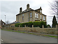
The Knowle, Clough Street, Morley
This is the largest house in the locality, bearing a date of 1889. It had not been picked up by O.S. surveyors for the 1894 edition of the 25-inch map, but is shown by 1908 and named by 1933.
Image: © Stephen Craven
Taken: 11 Jan 2020
0.10 miles
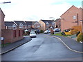
7
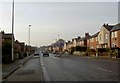
Wide Lane - viewed from Middleton Road
Image: © Betty Longbottom
Taken: 17 Mar 2012
0.11 miles
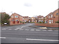
8
Priority this way
Middleton Road, Morley.
Image: © Steve Fareham
Taken: 14 Jan 2009
0.11 miles