IMAGES TAKEN NEAR TO
Harrier Way, LEEDS, LS27 8TG
Introduction
This page details the photographs taken nearby to Harrier Way, LS27 8TG by members of the Geograph project.
The Geograph project started in 2005 with the aim of publishing, organising and preserving representative images for every square kilometre of Great Britain, Ireland and the Isle of Man.

There are currently over 7.5m images from over14,400 individuals and you can help contribute to the project by visiting https://www.geograph.org.uk
Image Map (Loading...)


Getting Data...Please wait
Leaflet Map data © OpenStreetMap
Images are licensed for reuse under creativecommons.org/licenses/by-sa/2.0
Notes
- Clicking on the map will re-center to the selected point.
- The higher the marker number, the further away the image location is from the centre of the postcode.
Image Listing (72 Images Found)
Images are licensed for reuse under creativecommons.org/licenses/by-sa/2.0
Image
Details
Distance
5
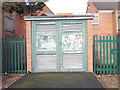
Electricity Substation No 7235 - Magpie Lane
Image: © Betty Longbottom
Taken: 17 Mar 2012
0.06 miles
7
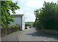
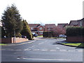
Bantam Grove Lane, Morley
This led to mills at Bantam Grove, now replaced by houses.
Image: © Humphrey Bolton
Taken: 3 Jun 2010
0.07 miles