IMAGES TAKEN NEAR TO
Wide Lane, LEEDS, LS27 8SS
Introduction
This page details the photographs taken nearby to Wide Lane, LS27 8SS by members of the Geograph project.
The Geograph project started in 2005 with the aim of publishing, organising and preserving representative images for every square kilometre of Great Britain, Ireland and the Isle of Man.

There are currently over 7.5m images from over14,400 individuals and you can help contribute to the project by visiting https://www.geograph.org.uk
Image Map
Images are licensed for reuse under creativecommons.org/licenses/by-sa/2.0
Notes
- Clicking on the map will re-center to the selected point.
- The higher the marker number, the further away the image location is from the centre of the postcode.
Image Listing (37 Images Found)
Images are licensed for reuse under creativecommons.org/licenses/by-sa/2.0
Image
Details
Distance
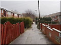
1
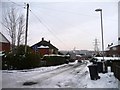
Eastern end of Newlands Drive, Morley
It must be bin day.
Image: © Christine Johnstone
Taken: 23 Jan 2013
0.02 miles
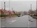
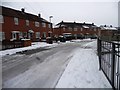
2
Junction of Newlands Crescent and Newlands Drive
The snow shows the differing qualities of roof insulation.
Image: © Christine Johnstone
Taken: 23 Jan 2013
0.03 miles
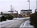
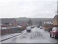
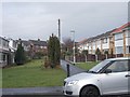
3
Wide Lane - viewed from Topcliffe Avenue
Image: © Betty Longbottom
Taken: 17 Mar 2012
0.05 miles
5
Topcliffe Court - Topcliffe Avenue
Image: © Betty Longbottom
Taken: 17 Mar 2012
0.06 miles
7
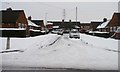
Bungalows on Newlands Drive, Morley
A snow-filled cul-de-sac on the north side of the road.
Image: © Christine Johnstone
Taken: 23 Jan 2013
0.07 miles
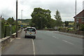
8
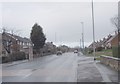
Wide Lane - viewed from Topcliffe Avenue
Image: © Betty Longbottom
Taken: 17 Mar 2012
0.07 miles
9
Eastern end of Newlands Crescent
These houses are built in blocks of four.
Image: © Christine Johnstone
Taken: 23 Jan 2013
0.08 miles
10
Topcliffe Green - Topcliffe Avenue
Image: © Betty Longbottom
Taken: 17 Mar 2012
0.08 miles