IMAGES TAKEN NEAR TO
Clough Street, LEEDS, LS27 8RW
Introduction
This page details the photographs taken nearby to Clough Street, LS27 8RW by members of the Geograph project.
The Geograph project started in 2005 with the aim of publishing, organising and preserving representative images for every square kilometre of Great Britain, Ireland and the Isle of Man.

There are currently over 7.5m images from over14,400 individuals and you can help contribute to the project by visiting https://www.geograph.org.uk
Image Map
Images are licensed for reuse under creativecommons.org/licenses/by-sa/2.0
Notes
- Clicking on the map will re-center to the selected point.
- The higher the marker number, the further away the image location is from the centre of the postcode.
Image Listing (121 Images Found)
Images are licensed for reuse under creativecommons.org/licenses/by-sa/2.0
Image
Details
Distance
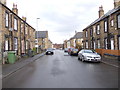
1
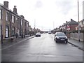
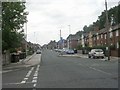
Clough Street - viewed from Denshaw Drive
Image: © Betty Longbottom
Taken: 17 Mar 2012
0.03 miles
3
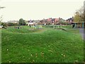
Playground in Lewisham Park, Morley
Work on the park had started before World War 1 and it was finally opened on 8 August 1914. The choice of name reflects the London interests of the Earls of Dartmouth who gave the land, and the park was opened by the 6th Earl.
Image: © Stephen Craven
Taken: 11 Nov 2022
0.04 miles
5
Clough Street - viewed from Denshaw Drive
Image: © Betty Longbottom
Taken: 17 Mar 2012
0.05 miles
6
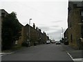
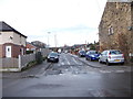
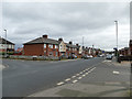
Clough Street - viewed from Peel Street
Image: © Betty Longbottom
Taken: 21 Sep 2009
0.06 miles
7
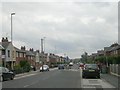
Middleton Road - viewed from Clough Street
Image: © Betty Longbottom
Taken: 15 Sep 2009
0.06 miles
9
Middleton Road - viewed from Clough Street
Image: © Betty Longbottom
Taken: 15 Sep 2009
0.07 miles
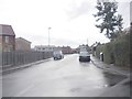
10
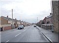
Junction of Middleton Road and Clough Street, Morley
The 1922 O.S. map shows Middleton Road terminating some way west of here, but by 1933 it had been extended eastwards and these houses are shown on it.
Image: © Stephen Craven
Taken: 11 Jan 2020
0.07 miles