
IMAGES TAKEN NEAR TO
Albert Road, LEEDS, LS27 8RU
Introduction
This page details the photographs taken nearby to Albert Road, LS27 8RU by members of the Geograph project.
The Geograph project started in 2005 with the aim of publishing, organising and preserving representative images for every square kilometre of Great Britain, Ireland and the Isle of Man.

There are currently over 7.5m images from over14,400 individuals and you can help contribute to the project by visiting https://www.geograph.org.uk
Image Map
Images are licensed for reuse under creativecommons.org/licenses/by-sa/2.0
Notes
- Clicking on the map will re-center to the selected point.
- The higher the marker number, the further away the image location is from the centre of the postcode.
Image Listing (120 Images Found)
Images are licensed for reuse under creativecommons.org/licenses/by-sa/2.0
Image
Details
Distance
1
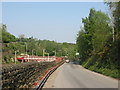
Valley Road
With Morley Railway Station over the wall.
Image: © Stephen Armstrong
Taken: 22 Apr 2011
0.08 miles
2
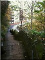
Steps to Morley station
Because the town is on a hill, the railway had to run in tunnel under it and the station is some way from the town, and in a cutting. These steps link Albert Road and Valley Road as a shortcut for pedestrians. There are 91 steps altogether. See Image for a view up from the bottom.
Image: © Stephen Craven
Taken: 11 Nov 2022
0.08 miles
3
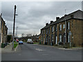
Two periods of housing, Peel Street, Morley
The 1933 OS map shows Peel Street stopping at the few terraced houses beyond this junction with Clough Street. Later housing (probably 1960s) is set much further back from the road, reflecting the growing expectations of post-war homeowners.
Image: © Stephen Craven
Taken: 11 Jan 2020
0.08 miles
4
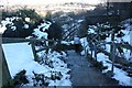
Station Walk, Morley
The direct walking route from Morley town centre to the station goes along Station Walk (by the Miners' Arms) and then down a series of about 67 steps to Valley Road. The station can be seen in the background. The gentleman was using the steps as a training route!
Image: © Richard Kay
Taken: 6 Dec 2010
0.09 miles
5

Electricity Substation No 603 - Albert Road
Image: © Betty Longbottom
Taken: 3 Oct 2011
0.09 miles
6
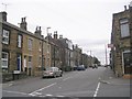
Clough Street - viewed from Ackroyd Street
Image: © Betty Longbottom
Taken: 21 Sep 2009
0.09 miles
7
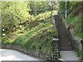
Steps from Valley Road up to Albert Road
Image: © Stephen Armstrong
Taken: 22 Apr 2011
0.09 miles
8
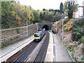
Train entering Morley tunnel
Because the town is on a hill, the railway had to run in tunnel under it and the station is some way from the town, and in a cutting. The station opened in 1848 and was originally called 'Morley Low' to distinguish it from 'Morley Top' which closed in 1961.
The tunnel is 3081 metres long, built in 1845-1848. During construction, 23 working shafts were sunk in addition to the four permanent shafts Image
The train is a TransPennine Express local service, calling at all stations from Leeds to Huddersfield.
Image: © Stephen Craven
Taken: 11 Nov 2022
0.09 miles
9

Vacuum Excavation - Outside Miners Arms, Morley
Image: © Thomas Roberts
Taken: 8 Jan 2015
0.09 miles
10
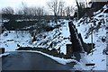
Station Walk Steps at Valley Road, Morley
Valley Road is a private road leading to a re-cycling depot. The sign warns vehicle drivers to avoid the parapet wall on the left which surmounts the tunnel mouth. The flight of steps on the right leads directly from the railway station to Station Walk and Morley town centre.
Image: © Richard Kay
Taken: 6 Dec 2010
0.09 miles