
IMAGES TAKEN NEAR TO
Daisy Hill, LEEDS, LS27 8NG
Introduction
This page details the photographs taken nearby to Daisy Hill, LS27 8NG by members of the Geograph project.
The Geograph project started in 2005 with the aim of publishing, organising and preserving representative images for every square kilometre of Great Britain, Ireland and the Isle of Man.

There are currently over 7.5m images from over14,400 individuals and you can help contribute to the project by visiting https://www.geograph.org.uk
Image Map
Images are licensed for reuse under creativecommons.org/licenses/by-sa/2.0
Notes
- Clicking on the map will re-center to the selected point.
- The higher the marker number, the further away the image location is from the centre of the postcode.
Image Listing (73 Images Found)
Images are licensed for reuse under creativecommons.org/licenses/by-sa/2.0
Image
Details
Distance
2
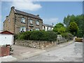
Houses at Daisy Hill, Morley
Daisy Hill was a mill hamlet, detached from the Morley built-up area. Behind these houses there was Daisy Hill Mills (Woollen). Nearby were Gath's Buildings, a block of back-to-back houses, and more back-to-backs sloping away from the road down into the valley.
Image: © Humphrey Bolton
Taken: 3 Jun 2010
0.03 miles
3
New Bank Street - viewed from King George Avenue
Image: © Betty Longbottom
Taken: 21 Sep 2009
0.04 miles
4
King George Avenue - New Bank Street
Image: © Betty Longbottom
Taken: 21 Sep 2009
0.04 miles
5
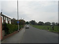
Daisy Hill - viewed from King George Avenue
Image: © Betty Longbottom
Taken: 3 Oct 2011
0.05 miles
6
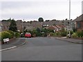
Croft House Avenue - King George Avenue
Image: © Betty Longbottom
Taken: 21 Sep 2009
0.08 miles
7
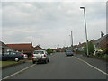
King George Avenue - viewed from Croft House Avenue
Image: © Betty Longbottom
Taken: 3 Oct 2011
0.09 miles
8
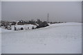
Snowy Daisy Hill
Morley, Daisy Hill in the snow
Image: © mark dale
Taken: 24 Dec 2008
0.09 miles
10
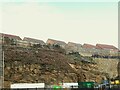
Faulted strata at Morley
An exposed face of a syncline in the highly faulted strata of the Coal Measures at the back of what was the LNWR goods yard of Morley station. The houses on top of the rocks (called Station View) are quite recent and built on the site of Daisy Hill farm.
Image: © Stephen Craven
Taken: 11 Nov 2022
0.10 miles