IMAGES TAKEN NEAR TO
Harwill Croft, LEEDS, LS27 7PG
Introduction
This page details the photographs taken nearby to Harwill Croft, LS27 7PG by members of the Geograph project.
The Geograph project started in 2005 with the aim of publishing, organising and preserving representative images for every square kilometre of Great Britain, Ireland and the Isle of Man.

There are currently over 7.5m images from over14,400 individuals and you can help contribute to the project by visiting https://www.geograph.org.uk
Image Map (Loading...)


Getting Data...Please wait
Leaflet Map data © OpenStreetMap
Images are licensed for reuse under creativecommons.org/licenses/by-sa/2.0
Notes
- Clicking on the map will re-center to the selected point.
- The higher the marker number, the further away the image location is from the centre of the postcode.
Image Listing (97 Images Found)
Images are licensed for reuse under creativecommons.org/licenses/by-sa/2.0
Image
Details
Distance
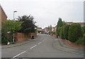
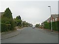
3
Harwill Road - viewed from Harwill Avenue
Image: © Betty Longbottom
Taken: 21 Sep 2009
0.06 miles
4
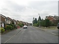
Harwill Road - viewed from Harwill Avenue
Image: © Betty Longbottom
Taken: 21 Sep 2009
0.06 miles
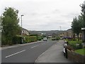
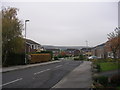
7
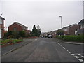
Harwill Road - looking towards Harwill Approach
Image: © Betty Longbottom
Taken: 7 Nov 2011
0.07 miles
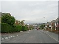
8
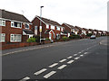
Harwill Road, Churwell
A housing estate of probably 1960s or 1970s date.
Image: © Stephen Craven
Taken: 21 Jul 2020
0.09 miles
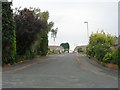
10
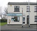
The co-operative pharmacy - Elland Road
Image: © Betty Longbottom
Taken: 31 Mar 2010
0.10 miles