IMAGES TAKEN NEAR TO
Richmond Close, LEEDS, LS27 0RL
Introduction
This page details the photographs taken nearby to Richmond Close, LS27 0RL by members of the Geograph project.
The Geograph project started in 2005 with the aim of publishing, organising and preserving representative images for every square kilometre of Great Britain, Ireland and the Isle of Man.

There are currently over 7.5m images from over14,400 individuals and you can help contribute to the project by visiting https://www.geograph.org.uk
Image Map (Loading...)


Getting Data...Please wait
Leaflet Map data © OpenStreetMap
Images are licensed for reuse under creativecommons.org/licenses/by-sa/2.0
Notes
- Clicking on the map will re-center to the selected point.
- The higher the marker number, the further away the image location is from the centre of the postcode.
Image Listing (177 Images Found)
Images are licensed for reuse under creativecommons.org/licenses/by-sa/2.0
Image
Details
Distance
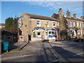
3
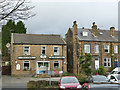
The Morley Dashers, High Street
The pub still bears the brewery name Samuel Websters, although the Halifax brewery lost its independence in 1917 and closed in 1996.
Image: © Stephen Craven
Taken: 11 Jan 2020
0.06 miles
4
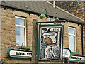
Sign for the Morley Dashers
A rather surreal sign. See Image for context.
Image: © Stephen Craven
Taken: 11 Jan 2020
0.07 miles
6
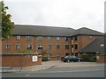
Chartists Court - Great Northern Street
This is an Anchor Housing Complex.
Image: © Betty Longbottom
Taken: 15 Sep 2009
0.08 miles
8
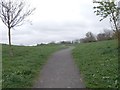
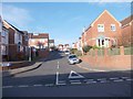
Footpath to Recreation Ground - off High Street
Image: © Betty Longbottom
Taken: 3 Apr 2012
0.09 miles
10
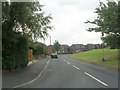
Morley (Top) railway station (site), Yorkshire
Opened in 1857 by the Great Northern Railway on the line from Wakefield to Halifax, this station closed in 1969.
View south east towards Tingley and Wakefield. The line ran parallel to, and just behind the wall, and would have cut across the near corner of the building before running onto a viaduct, one abutment of which can still be seen on High Street. The new road in the foreground cuts across the former goods yard. The Stationmaster's house still survives, just behind the camera position.
Image: © Nigel Thompson
Taken: 1 Dec 2013
0.10 miles