IMAGES TAKEN NEAR TO
Jowett Terrace, LEEDS, LS27 0DG
Introduction
This page details the photographs taken nearby to Jowett Terrace, LS27 0DG by members of the Geograph project.
The Geograph project started in 2005 with the aim of publishing, organising and preserving representative images for every square kilometre of Great Britain, Ireland and the Isle of Man.

There are currently over 7.5m images from over14,400 individuals and you can help contribute to the project by visiting https://www.geograph.org.uk
Image Map
Images are licensed for reuse under creativecommons.org/licenses/by-sa/2.0
Notes
- Clicking on the map will re-center to the selected point.
- The higher the marker number, the further away the image location is from the centre of the postcode.
Image Listing (97 Images Found)
Images are licensed for reuse under creativecommons.org/licenses/by-sa/2.0
Image
Details
Distance
2
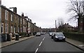
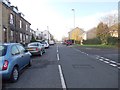
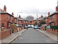
High Street - viewed from Harlington Road
Image: © Betty Longbottom
Taken: 19 Nov 2011
0.02 miles
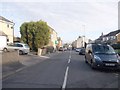
3
High Street - viewed from Harlington Road
Image: © Betty Longbottom
Taken: 19 Nov 2011
0.03 miles
5
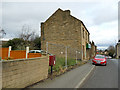
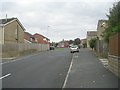
Postbox on Morley High Street
High Street is a residential rather than retail area.
Image: © Stephen Craven
Taken: 11 Jan 2020
0.03 miles
6
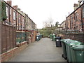
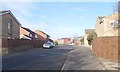
Houses on Morley High Street
An older house, later extended, fronts the road, with a more recent one set back.
Image: © Stephen Craven
Taken: 11 Jan 2020
0.04 miles
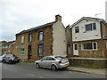
8
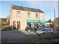
Bathrooms of Distinction - High Street
Image: © Betty Longbottom
Taken: 19 Nov 2011
0.04 miles