
IMAGES TAKEN NEAR TO
Chestnut Grove, LEEDS, LS26 8WU
Introduction
This page details the photographs taken nearby to Chestnut Grove, LS26 8WU by members of the Geograph project.
The Geograph project started in 2005 with the aim of publishing, organising and preserving representative images for every square kilometre of Great Britain, Ireland and the Isle of Man.

There are currently over 7.5m images from over14,400 individuals and you can help contribute to the project by visiting https://www.geograph.org.uk
Image Map
Images are licensed for reuse under creativecommons.org/licenses/by-sa/2.0
Notes
- Clicking on the map will re-center to the selected point.
- The higher the marker number, the further away the image location is from the centre of the postcode.
Image Listing (35 Images Found)
Images are licensed for reuse under creativecommons.org/licenses/by-sa/2.0
Image
Details
Distance
2
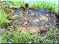
Benchmark on canalside wall
Ordnance Survey rivet benchmark on the bank of the Aire and Calder Navigation described on the Bench Mark Database at http://www.bench-marks.org.uk/bm48792
Image: © Roger Templeman
Taken: 30 May 2013
0.08 miles
3
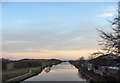
Aire and Calder Navigation
The canal at Woodlesford, looking east.
Image: © BC
Taken: 10 Dec 2005
0.08 miles
4
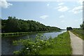
Canal near Woodlesford
The path running beside the Aire and Calder Navigation forms part of National Cycle Network route 67.
Image: © DS Pugh
Taken: 26 May 2023
0.09 miles
5
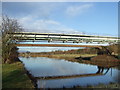
Pipe bridge over Aire and Calder Navigation
Image: © JThomas
Taken: 17 Dec 2011
0.09 miles
6
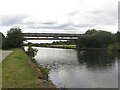
Bridges crossing the Aire and Calder Navigation
Looking westwards towards a pair of bridges which cross the Aire and Calder Navigation.
Image: © Graham Robson
Taken: 3 Aug 2015
0.09 miles
7
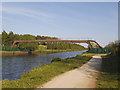
Pipe bridges across the Aire and Calder Navigation
There's an oil depot nearby Image so I guess these are oil pipelines. The towpath here forms part of the Leeds Country Way.
Image: © Stephen Craven
Taken: 14 May 2019
0.09 miles
8
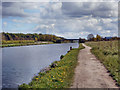
Looking back to Fleets lane
Aire and Calder Navigation Canal at Woodlesford
Image: © derek dye
Taken: 3 May 2016
0.09 miles
10
Services bridges over the Aire and Calder Navigation
There is an OS benchmark Image on the canal bankside wall where the turf has been cleared to expose it
Image: © Roger Templeman
Taken: 30 May 2013
0.09 miles