
IMAGES TAKEN NEAR TO
Wood Lane, LEEDS, LS26 0QN
Introduction
This page details the photographs taken nearby to Wood Lane, LS26 0QN by members of the Geograph project.
The Geograph project started in 2005 with the aim of publishing, organising and preserving representative images for every square kilometre of Great Britain, Ireland and the Isle of Man.

There are currently over 7.5m images from over14,400 individuals and you can help contribute to the project by visiting https://www.geograph.org.uk
Image Map
Images are licensed for reuse under creativecommons.org/licenses/by-sa/2.0
Notes
- Clicking on the map will re-center to the selected point.
- The higher the marker number, the further away the image location is from the centre of the postcode.
Image Listing (181 Images Found)
Images are licensed for reuse under creativecommons.org/licenses/by-sa/2.0
Image
Details
Distance
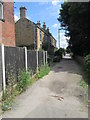
2
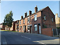
Houses on Wood Lane, Rothwell
The newer houses to the left are built on the site of a railway embankment.
Image: © Stephen Craven
Taken: 23 Jul 2019
0.01 miles
3
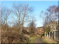
Path alongside Churchfields, Rothwell
Heading towards Church Street / Wood Lane.
Image: © Christine Johnstone
Taken: 30 Dec 2014
0.02 miles
4
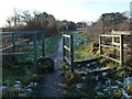
Gated entrance to Rothwell Pastures
Along with the disused railway, the pastures are a large area of public open space on the western edge of the village.
Image: © Christine Johnstone
Taken: 30 Dec 2014
0.03 miles
5
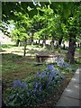
Bluebells
Bluebells in Rothwell churchyard
Image: © Mike Kirby
Taken: 7 May 2009
0.04 miles
6
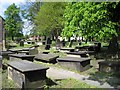
Rothwell parish church (Holy Trinity) graveyard
The graveyard of Holy Trinity is mainly at the rear of the church. Table or box tombs, of which there are many, were most common during the nineteenth century.
Image: © Mike Kirby
Taken: 7 May 2009
0.04 miles
7
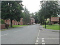
Wood Lane - viewed from Pasture View Road
Image: © Betty Longbottom
Taken: 30 Jun 2014
0.04 miles
8
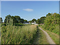
Rothwell Pastures
A small public open space on the site of the former Rothwell Haigh Colliery.
Image: © Stephen Craven
Taken: 23 Jul 2019
0.05 miles
9
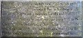
Gravestone centenary detail of John Blenkinsop
Further lettering added at the centenary records that "John Blenkinsop invented the rack railway in 1811 and on a line he built between Leeds and Middleton, four Matthew Murray locomotives ran from 1812 to 1835. His system was adopted at Newcastle on Tyne in 1813 and Wigan in 1814. These railways were the first an which steam locomotion was a commercial success".
See Image
Image: © Mike Kirby
Taken: 7 May 2009
0.05 miles
10
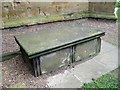
John Blenkinsop?s grave
The grave of John Blenkinsop is approx. 2 metres north of the tower of the Church of the Holy Trinity in Rothwell. The gravestone has a grade II listing. Ref:- http://en.wikipedia.org/wiki/John_Blenkinsop
Image: © Mike Kirby
Taken: 7 May 2009
0.05 miles