IMAGES TAKEN NEAR TO
Royds Lane, LEEDS, LS26 0BH
Introduction
This page details the photographs taken nearby to Royds Lane, LS26 0BH by members of the Geograph project.
The Geograph project started in 2005 with the aim of publishing, organising and preserving representative images for every square kilometre of Great Britain, Ireland and the Isle of Man.

There are currently over 7.5m images from over14,400 individuals and you can help contribute to the project by visiting https://www.geograph.org.uk
Image Map
Images are licensed for reuse under creativecommons.org/licenses/by-sa/2.0
Notes
- Clicking on the map will re-center to the selected point.
- The higher the marker number, the further away the image location is from the centre of the postcode.
Image Listing (159 Images Found)
Images are licensed for reuse under creativecommons.org/licenses/by-sa/2.0
Image
Details
Distance
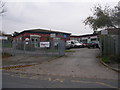
5
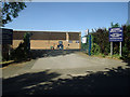
Rothwell Sports Club, Royds Lane
Indoor and outdoor sports available.
Image: © Stephen Craven
Taken: 28 May 2020
0.09 miles
6
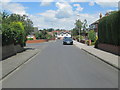
The Oval - looking towards Oulton Lane
Image: © Betty Longbottom
Taken: 30 Jun 2014
0.10 miles
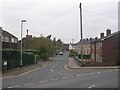
9
St Mary's Roman Catholic Primary School - Royds Lane
Image: © Betty Longbottom
Taken: 30 Oct 2009
0.11 miles
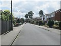
10
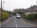
Springfield Rise - Springfield Street
Image: © Betty Longbottom
Taken: 30 Oct 2009
0.11 miles