IMAGES TAKEN NEAR TO
Lincoln Way, LEEDS, LS25 6QX
Introduction
This page details the photographs taken nearby to Lincoln Way, LS25 6QX by members of the Geograph project.
The Geograph project started in 2005 with the aim of publishing, organising and preserving representative images for every square kilometre of Great Britain, Ireland and the Isle of Man.

There are currently over 7.5m images from over14,400 individuals and you can help contribute to the project by visiting https://www.geograph.org.uk
Image Map
Images are licensed for reuse under creativecommons.org/licenses/by-sa/2.0
Notes
- Clicking on the map will re-center to the selected point.
- The higher the marker number, the further away the image location is from the centre of the postcode.
Image Listing (44 Images Found)
Images are licensed for reuse under creativecommons.org/licenses/by-sa/2.0
Image
Details
Distance
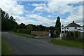
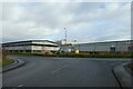
4
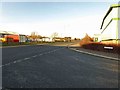
Lincoln Way junction Sherburn industrial park
Image: © Steve Fareham
Taken: 8 Dec 2014
0.11 miles
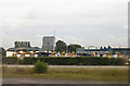
5

Supercook
Supercook factory Sherburn industrial estate, from Bishopdyke Road.
Image: © Steve Fareham
Taken: 26 Jun 2008
0.11 miles
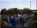
6
Oak Terrace
Looking along Oak Terrace leading to Sherburn in Elmet railway station.
Image: © DS Pugh
Taken: 13 Jun 2021
0.12 miles
7
Britannia Building Supplies on Moxon drive
Part of Moor Lane trading estate. Viewed from railway just south of Sherburn in Elmet Station
Image: © John Firth
Taken: 18 Aug 2011
0.14 miles
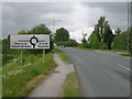
9
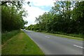
Fenton Lane
Looking along Fenton Lane just north of Sherburn in Elmet.
Image: © DS Pugh
Taken: 13 Jun 2021
0.16 miles
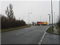
10
Junction with Aviation Road
Looking along Moxon Way on Sherburn industrial estate.
Image: © DS Pugh
Taken: 9 Jan 2022
0.16 miles