IMAGES TAKEN NEAR TO
Bramble Court, LEEDS, LS25 6ND
Introduction
This page details the photographs taken nearby to Bramble Court, LS25 6ND by members of the Geograph project.
The Geograph project started in 2005 with the aim of publishing, organising and preserving representative images for every square kilometre of Great Britain, Ireland and the Isle of Man.

There are currently over 7.5m images from over14,400 individuals and you can help contribute to the project by visiting https://www.geograph.org.uk
Image Map (Loading...)


Getting Data...Please wait
Leaflet Map data © OpenStreetMap
Images are licensed for reuse under creativecommons.org/licenses/by-sa/2.0
Notes
- Clicking on the map will re-center to the selected point.
- The higher the marker number, the further away the image location is from the centre of the postcode.
Image Listing (137 Images Found)
Images are licensed for reuse under creativecommons.org/licenses/by-sa/2.0
Image
Details
Distance
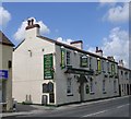
1
Footpath leading to Low Street, Sherburn in Elmet
Image: © Ian S
Taken: 23 Jul 2014
0.03 miles
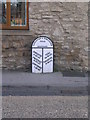
3

Old Milestone by Low Street, Sherburn in Elmet
Metal plate attached to stone post by Low Street, the former A162, in parish of SHERBURN (SELBY District), Sherburn opposite Cliff Garage, back to stone wall of house, on East side of road. Brayshaw & Booth iron casting, erected by the County Council in the 19th century.
Inscription reads:-
: DONCASTER / 21 MILES / PONTEFRACT / 8¾ MILES / FERRYBRIDGE / 6 MILES : : TADCASTER & DONCASTER / ROAD / SHERBURN : : YORK / 15¾ MILES / TADCASTER / 6¼ MILES :
Hole in top.
Maker:-
: BRAYSHAW & BOOTH / MAKERS / LIVERSEDGE :
North Yorkshire HER.
NY SMR Number: MNY36424 https://www.heritagegateway.org.uk/Gateway/Results_Single.aspx?uid=MNY36424&resourceID=1009
Milestone Society National ID: YN_DNTC21.
Image: © C Minto
Taken: 1 Jan 2002
0.04 miles
5
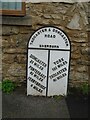
Old milestone
The 615 milestones set up for the West Riding CC in 1893/94 mostly had a protruding metal attachment to a backing stone. Where the space was narrow as on a pavement or bridge, flat castings were made. Less than 20 have been recorded. This one is on Low Street in Sherburn in Elmet which used to be the A162 until the by-pass was built. There is a hole in the top of the backing stone which may signify it was used by the Ordnance Survey as a bench mark. The foundry name Brayshaw & Booth Liversedge is cast just above DONCASTER.
Image: © Chris Minto
Taken: 9 Jan 2022
0.04 miles
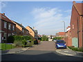
6
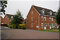
Houses on Copperfield Close, Sherburn in Elmet
Image: © Ian S
Taken: 23 Jul 2014
0.05 miles
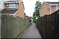
7
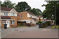
Public footpath on Copperfield Close
Sherburn in Elmet.
Image: © Ian S
Taken: 23 Jul 2014
0.05 miles
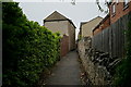
8
Pasture View - looking towards The Fairway
Image: © Betty Longbottom
Taken: 24 Oct 2011
0.06 miles