
IMAGES TAKEN NEAR TO
Ox Close Lane, WETHERBY, LS22 5HW
Introduction
This page details the photographs taken nearby to Ox Close Lane, LS22 5HW by members of the Geograph project.
The Geograph project started in 2005 with the aim of publishing, organising and preserving representative images for every square kilometre of Great Britain, Ireland and the Isle of Man.

There are currently over 7.5m images from over14,400 individuals and you can help contribute to the project by visiting https://www.geograph.org.uk
Image Map
Images are licensed for reuse under creativecommons.org/licenses/by-sa/2.0
Notes
- Clicking on the map will re-center to the selected point.
- The higher the marker number, the further away the image location is from the centre of the postcode.
Image Listing (26 Images Found)
Images are licensed for reuse under creativecommons.org/licenses/by-sa/2.0
Image
Details
Distance
1
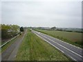
A168 and the old A1
Still easy to tell that this was recently dual carriageway. Now the A168, this was the A1, which has been upgraded to motorway standards and can be seen on the right of this photo.
Image: © DS Pugh
Taken: 14 Apr 2009
0.01 miles
2
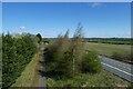
Cycle path to Walshford
Looking down on the former A1 now labelled as the A168 with some carriageways given over to a cycle path.
Image: © DS Pugh
Taken: 5 Apr 2021
0.02 miles
3
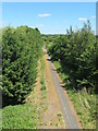
Former northbound lane of A1
The line of the former northbound lane of the A1 at Ox Close, with the road now largely filled in but leaving space for a cycle way. Some old lane markings still visible.
Image: © Gordon Hatton
Taken: 1 Jun 2020
0.02 miles
4
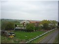
Ox Close Farm
A much quieter location now the A1 has moved half a mile away.
Image: © DS Pugh
Taken: 14 Apr 2009
0.02 miles
5

'Tis the season for chipped windscreens
Workers resurfacing the A168 at Ox Close. This appears to be the usual British 'economy' method of surfacing roads with chippings, some of which will inevitably hit car windscreens or chip bonnets. I've never seen this method used on the Continent. This section of A168 was once the southbound lane of the old A1.
Image: © Gordon Hatton
Taken: 1 Jun 2020
0.03 miles
6
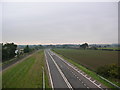
The old A1
This confused me as my map was out of date. I stood here for a while wondering why the A1 was empty before noticing the A1(M). This road is now called the A168.
Image: © DS Pugh
Taken: 25 Sep 2006
0.04 miles

8

Ox Close Lane going west
The left turn takes you down onto the A168
Image: © Martin Dawes
Taken: 9 Jul 2016
0.09 miles
9
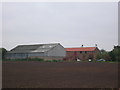
Ox Close Farm
Situated next to the old A1 [now A168], the road runs just behind the farm. This is taken from the Cowthorpe road which passes over the A168.
Image: © DS Pugh
Taken: 25 Sep 2006
0.09 miles
10
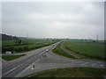
A168 South
Until recently this was the A1. Now a new motorway standard A1 has been constructed about half a mile east from here.
Image: © DS Pugh
Taken: 14 Apr 2009
0.10 miles