IMAGES TAKEN NEAR TO
Harrogate Road, WETHERBY, LS22 4AN
Introduction
This page details the photographs taken nearby to Harrogate Road, LS22 4AN by members of the Geograph project.
The Geograph project started in 2005 with the aim of publishing, organising and preserving representative images for every square kilometre of Great Britain, Ireland and the Isle of Man.

There are currently over 7.5m images from over14,400 individuals and you can help contribute to the project by visiting https://www.geograph.org.uk
Image Map
Images are licensed for reuse under creativecommons.org/licenses/by-sa/2.0
Notes
- Clicking on the map will re-center to the selected point.
- The higher the marker number, the further away the image location is from the centre of the postcode.
Image Listing (13 Images Found)
Images are licensed for reuse under creativecommons.org/licenses/by-sa/2.0
Image
Details
Distance
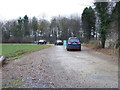
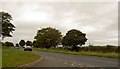
3

Cattle grid at the entrance to Stockeld Park
Image: © steven ruffles
Taken: 31 Aug 2019
0.12 miles
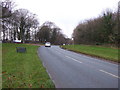
6
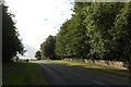
A661 Harrogate Road near Stockeld Park
Image: © Mark Anderson
Taken: 31 Jul 2018
0.17 miles
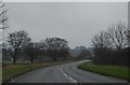
7
A661, Harrogate Road
The main road outside Stockeld Park
Image: © Chris Heaton
Taken: 11 Oct 2015
0.19 miles

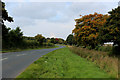
9
The A661 to Harrogate near Stockeld Park
Image: © Steve Fareham
Taken: 10 Oct 2008
0.21 miles
10
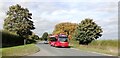
The no. 7 bus on Wetherby Road (A661), Stockeld, Spofforth
Image: © habiloid
Taken: 9 Oct 2022
0.23 miles