
IMAGES TAKEN NEAR TO
Swinsty, OTLEY, LS21 2NW
Introduction
This page details the photographs taken nearby to LS21 2NW by members of the Geograph project.
The Geograph project started in 2005 with the aim of publishing, organising and preserving representative images for every square kilometre of Great Britain, Ireland and the Isle of Man.

There are currently over 7.5m images from over14,400 individuals and you can help contribute to the project by visiting https://www.geograph.org.uk
Image Map
Images are licensed for reuse under creativecommons.org/licenses/by-sa/2.0
Notes
- Clicking on the map will re-center to the selected point.
- The higher the marker number, the further away the image location is from the centre of the postcode.
Image Listing (8 Images Found)
Images are licensed for reuse under creativecommons.org/licenses/by-sa/2.0
Image
Details
Distance
1
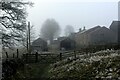
Nether Timble (1)
Early 17th Century Farm, with 19th Century modifications, passed through on a bridleway called High Lane.
Grade II Listed Building
Image: © Chris Heaton
Taken: 12 Dec 2022
0.01 miles
2
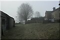
Nether Timble (2)
Early 17th Century with 19th Century modifications. Grade II Listed Building.
Image: © Chris Heaton
Taken: 12 Dec 2022
0.01 miles
3
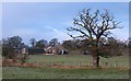
Bride Cross Farm
Bride Cross Farm is situated on the western flank of the Washburn valley, and is seen here from the permissive path along the valley bottom.
Image: © Gordon Hatton
Taken: 17 Jan 2012
0.13 miles
4
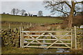
High Lane, Nether Timble
Farm track leading to Nether Timble
Image: © John Sparshatt
Taken: 15 Feb 2009
0.16 miles
5
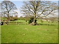
Fields near Nether Timble
The route of the Six Dales Trail is through the gate on the left to the farm and High Lane (tk) The buildings to the right of the large tree are Bride Cross Farm
Image: © Martin Dawes
Taken: 20 Apr 2015
0.17 miles
6

Footpath in Pasture East of Timble
A country scene of freezing fog in the Washburn Valley
Image: © Chris Heaton
Taken: 12 Dec 2022
0.18 miles
7

Wallside footpath used by the Six Dales Trail
Looking southward.
Image: © Peter Wood
Taken: 20 Jul 2017
0.19 miles
8
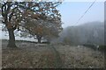
Approaching Swinsty Moor Plantation
On a track called High Lane
Image: © Chris Heaton
Taken: 12 Dec 2022
0.24 miles