
IMAGES TAKEN NEAR TO
Low Snowdon, OTLEY, LS21 2NE
Introduction
This page details the photographs taken nearby to Low Snowdon, LS21 2NE by members of the Geograph project.
The Geograph project started in 2005 with the aim of publishing, organising and preserving representative images for every square kilometre of Great Britain, Ireland and the Isle of Man.

There are currently over 7.5m images from over14,400 individuals and you can help contribute to the project by visiting https://www.geograph.org.uk
Image Map
Images are licensed for reuse under creativecommons.org/licenses/by-sa/2.0
Notes
- Clicking on the map will re-center to the selected point.
- The higher the marker number, the further away the image location is from the centre of the postcode.
Image Listing (5 Images Found)
Images are licensed for reuse under creativecommons.org/licenses/by-sa/2.0
Image
Details
Distance
1
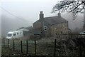
Midge Hall Farm
Farm in the Washburn Valley on a morning of freezing fog
Image: © Chris Heaton
Taken: 12 Dec 2022
0.02 miles
2
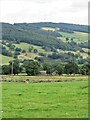
The Washburn valley
Looking east across the valley from Snowden Carr Road towards the communication mast on Norwood Edge on the far side.
Image: © Gordon Hatton
Taken: 28 Jul 2023
0.18 miles
3
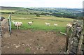
View over Dob Park
From footpath 15 141/13/1, looking down the slopes of the Washburn valley. On the extreme right is Swinsty Reservoir. The nearest farm is Midge Hall Farm.
Image: © Derek Harper
Taken: 28 Jul 2011
0.18 miles
4
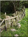
Difficult stile, Dobpark Wood
Footpath 15 141/13/1 enters the wood via this tumbledown stile, with loose boulders.
Image: © Derek Harper
Taken: 28 Jul 2011
0.20 miles
5
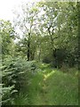
Dobpark Wood
Footpath 15 141/13/1 descends through the wood towards Low Park.
Image: © Derek Harper
Taken: 28 Jul 2011
0.24 miles