IMAGES TAKEN NEAR TO
Merrybank Lane, LEEDS, LS17 0EN
Introduction
This page details the photographs taken nearby to Merrybank Lane, LS17 0EN by members of the Geograph project.
The Geograph project started in 2005 with the aim of publishing, organising and preserving representative images for every square kilometre of Great Britain, Ireland and the Isle of Man.

There are currently over 7.5m images from over14,400 individuals and you can help contribute to the project by visiting https://www.geograph.org.uk
Image Map (Loading...)


Getting Data...Please wait
Leaflet Map data © OpenStreetMap
Images are licensed for reuse under creativecommons.org/licenses/by-sa/2.0
Notes
- Clicking on the map will re-center to the selected point.
- The higher the marker number, the further away the image location is from the centre of the postcode.
Image Listing (42 Images Found)
Images are licensed for reuse under creativecommons.org/licenses/by-sa/2.0
Image
Details
Distance
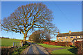
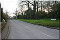
1
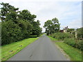
Merrybank Lane
Narrow lane leading from Huby towards Almscliff Crag
Image: © Chris Heaton
Taken: 15 Aug 2012
0.02 miles
2
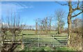
Huby, Merrybank Lane
According to the OS benchmark database there was a gatepost with a cut benchmark in this field entrance. Today there is no benchmark in this gatehole.
Image: © Mel Towler
Taken: 25 Feb 2022
0.07 miles
4
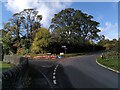
The junction of Crag Lane, The Sleights and Merrybank Lane, Huby
Image: © habiloid
Taken: 8 Oct 2022
0.11 miles
5
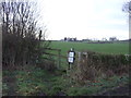
Footpath off Merrybank Lane
Towards Nat Lane.
Image: © JThomas
Taken: 17 Dec 2016
0.11 miles
6
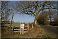
Stile and Footpath to Lower Banks Farm
Image: © Mark Anderson
Taken: 23 Jan 2019
0.11 miles
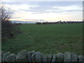
8
Merrybank Lane
Outskirts of Huby, North Yorkshire.
Image: © Wayland Smith
Taken: 27 Dec 2015
0.11 miles
10
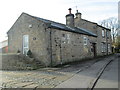
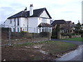
Sleights Mill & Cottage - Crag Lane
Image: © Betty Longbottom
Taken: 25 Nov 2014
0.13 miles