IMAGES TAKEN NEAR TO
Millshaw, LEEDS, LS11 8EG
Introduction
This page details the photographs taken nearby to Millshaw, LS11 8EG by members of the Geograph project.
The Geograph project started in 2005 with the aim of publishing, organising and preserving representative images for every square kilometre of Great Britain, Ireland and the Isle of Man.

There are currently over 7.5m images from over14,400 individuals and you can help contribute to the project by visiting https://www.geograph.org.uk
Image Map
Images are licensed for reuse under creativecommons.org/licenses/by-sa/2.0
Notes
- Clicking on the map will re-center to the selected point.
- The higher the marker number, the further away the image location is from the centre of the postcode.
Image Listing (51 Images Found)
Images are licensed for reuse under creativecommons.org/licenses/by-sa/2.0
Image
Details
Distance
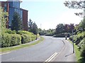
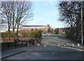
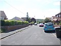
3
Global Avenue - looking towards Millshaw
Image: © Betty Longbottom
Taken: 30 May 2012
0.06 miles
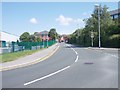
5
Millshaw road closure, Churwell
Here The Leeds Ring Road has cut across Millshaw, which has a point closure presumably to reduce the number of road junctions, although a short length is still accessible from the main road.
Image: © Humphrey Bolton
Taken: 16 Mar 2010
0.11 miles
6
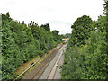
Railway north of Cardinal Road bridge
There is a footbridge about 100m away.
Image: © Stephen Craven
Taken: 15 Aug 2020
0.11 miles
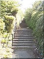
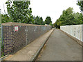
7
Footbridge DOL2/29 over Railway - Thirlmere Gardens
Image: © Betty Longbottom
Taken: 4 Dec 2007
0.13 miles
8
View from Bridge DOL2/29 - Thirlmere Gardens
Image: © Betty Longbottom
Taken: 30 May 2012
0.13 miles
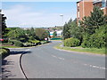
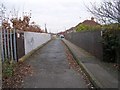
9
Thirlmere Gardens - looking towards Dewsbury Road
Image: © Betty Longbottom
Taken: 30 May 2012
0.13 miles
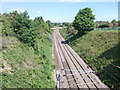
10
Railway overbridge, Cardinal Road, Beeston
Bollards prevent this being used as a through route by motor vehicles.
Image: © Stephen Craven
Taken: 15 Aug 2020
0.14 miles