IMAGES TAKEN NEAR TO
Hill Street, LEEDS, LS11 6AR
Introduction
This page details the photographs taken nearby to Hill Street, LS11 6AR by members of the Geograph project.
The Geograph project started in 2005 with the aim of publishing, organising and preserving representative images for every square kilometre of Great Britain, Ireland and the Isle of Man.

There are currently over 7.5m images from over14,400 individuals and you can help contribute to the project by visiting https://www.geograph.org.uk
Image Map (Loading...)


Getting Data...Please wait
Leaflet Map data © OpenStreetMap
Images are licensed for reuse under creativecommons.org/licenses/by-sa/2.0
Notes
- Clicking on the map will re-center to the selected point.
- The higher the marker number, the further away the image location is from the centre of the postcode.
Image Listing (203 Images Found)
Images are licensed for reuse under creativecommons.org/licenses/by-sa/2.0
Image
Details
Distance
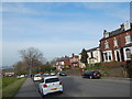
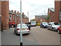
1
Beeston Road - viewed from Lodge Lane
Image: © Betty Longbottom
Taken: 21 Aug 2012
0.02 miles
4
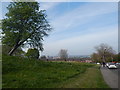
Open area on Beeston Road
In Beeston Hill, looking towards the city centre.
Image: © Hamish Griffin
Taken: 18 Apr 2019
0.04 miles
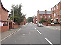
6
Beeston Road - viewed from Lodge Lane
Image: © Betty Longbottom
Taken: 21 Aug 2012
0.04 miles
7
Junior football pitch off Beeston Road
This small open space is on the site of demolished terraced housing on South Ridge Street, Southmount Street and Westmount Street.
Image: © Stephen Craven
Taken: 6 Apr 2024
0.04 miles
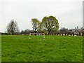
10
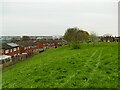
Green space off Beeston Road
This small open space is on the site of demolished terraced housing on South Ridge Street, Southmount Street and Westmount Street. The trees are labelled on OpenStreetMap as being 'Beeston Hill Community Orchard'.
Image: © Stephen Craven
Taken: 6 Apr 2024
0.07 miles