
IMAGES TAKEN NEAR TO
Malvern Road, LEEDS, LS11 6AH
Introduction
This page details the photographs taken nearby to Malvern Road, LS11 6AH by members of the Geograph project.
The Geograph project started in 2005 with the aim of publishing, organising and preserving representative images for every square kilometre of Great Britain, Ireland and the Isle of Man.

There are currently over 7.5m images from over14,400 individuals and you can help contribute to the project by visiting https://www.geograph.org.uk
Image Map
Images are licensed for reuse under creativecommons.org/licenses/by-sa/2.0
Notes
- Clicking on the map will re-center to the selected point.
- The higher the marker number, the further away the image location is from the centre of the postcode.
Image Listing (165 Images Found)
Images are licensed for reuse under creativecommons.org/licenses/by-sa/2.0
Image
Details
Distance
1
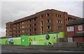
Disused Building awaiting conversion into flats - Beeston Road
This is the same property as the first geograph for this square, but viewed from Beeston Road.
Image: © Betty Longbottom
Taken: 4 Dec 2007
0.01 miles
2
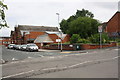
Beeston Hill United Free Church, Malvern Road
Image: © Roger Templeman
Taken: 9 Jul 2016
0.02 miles
3
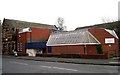
Beeston Hill United Free Church - Malvern Road
This is a joint Methodist, Baptist & United Reformed Church.
Image: © Betty Longbottom
Taken: 4 Dec 2007
0.02 miles
4
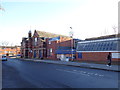
The United Free Church, Malvern Road, Leeds
This Church building is shared by the Baptists, Methodist and the United reformed Church
Image: © Bill Henderson
Taken: 2 Dec 2012
0.02 miles
5
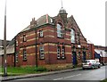
The Old Non-Conformist Church - Malvern Road
Image: © Betty Longbottom
Taken: 4 Dec 2007
0.03 miles
8
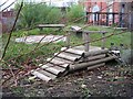
Disused Play Area - New Bewerley School - Beeston Road
Image: © Betty Longbottom
Taken: 4 Dec 2007
0.07 miles
9
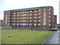
Disused building on Lady Pit Lane.
Beeston.
Image: © Steve Partridge
Taken: 27 Jan 2006
0.08 miles
10
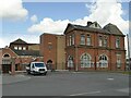
Hillside Conference Centre, Beeston
The former Beeston Hill Board School, built in 1880 to the designs of Richard Adams who also designed the nearby St Luke's Church. It is now used as a conference centre, with later extensions. See Image for the main frontage to Beeston Road; this is the south side of the building facing St Luke's Green. Listed grade II (list entry 1255905).
Image: © Stephen Craven
Taken: 2 Apr 2022
0.08 miles